MyTopo
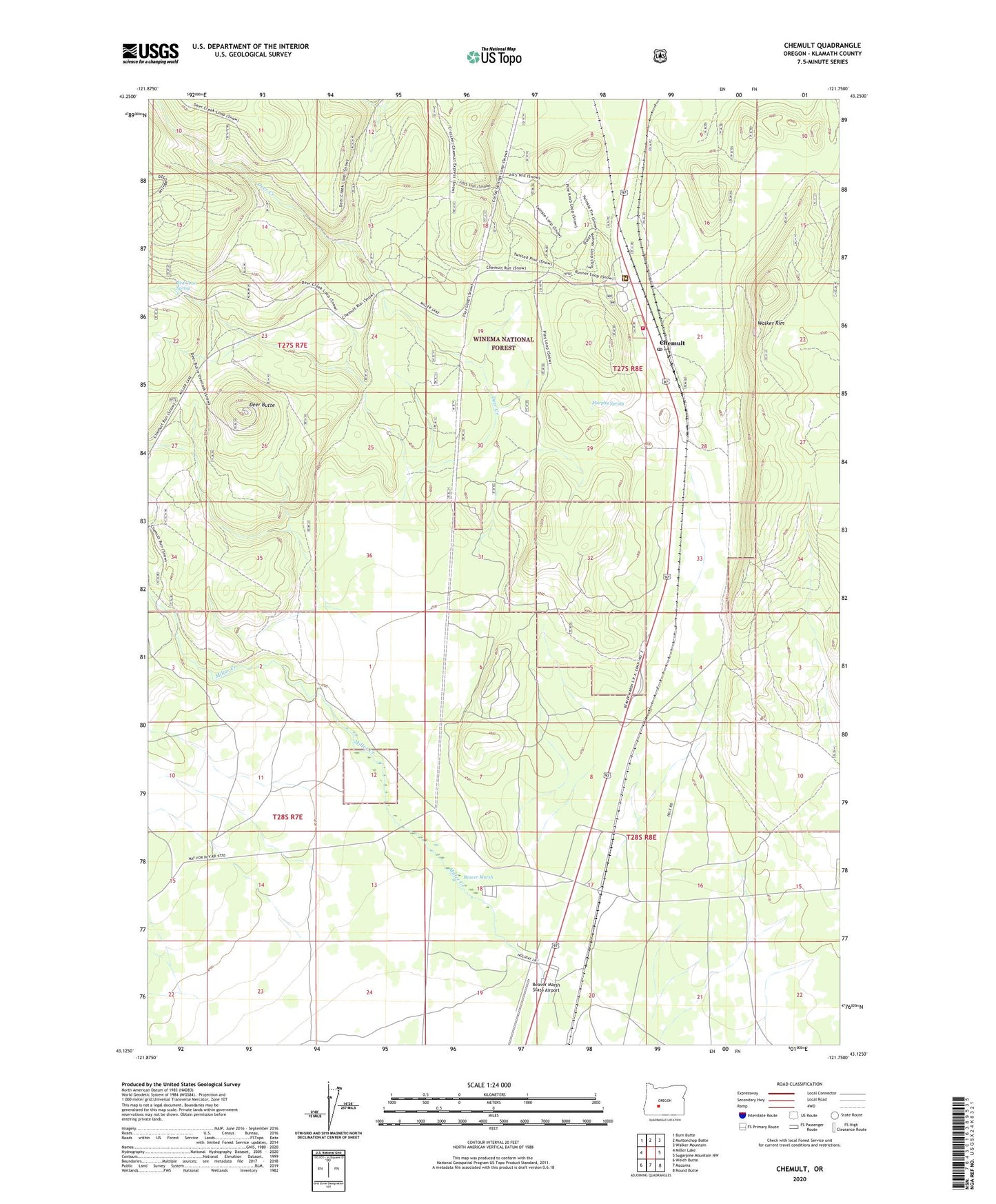
Chemult Oregon US Topo Map
Couldn't load pickup availability
Also explore the Chemult Forest Service Topo of this same quad for updated USFS data
2024 topographic map quadrangle Chemult in the state of Oregon. Scale: 1:24000. Based on the newly updated USGS 7.5' US Topo map series, this map is in the following counties: Klamath. The map contains contour data, water features, and other items you are used to seeing on USGS maps, but also has updated roads and other features. This is the next generation of topographic maps. Printed on high-quality waterproof paper with UV fade-resistant inks.
Quads adjacent to this one:
West: Miller Lake
Northwest: Burn Butte
North: Muttonchop Butte
Northeast: Walker Mountain
East: Sugarpine Mountain NW
Southeast: Round Butte
South: Mazama
Southwest: Welch Butte
This map covers the same area as the classic USGS quad with code o43121b7.
Contains the following named places: Beaver Marsh, Beaver Marsh Census Designated Place, Beaver Marsh Post Office, Beaver Marsh Safety Rest Area, Beaver Marsh State Airport, Chemult, Chemult Census Designated Place, Chemult Post Office, Chemult Ranger Station, Chemult Rural Fire Protection District Station 1 Headquarters, Deer Butte, Deer Creek, Diamond Lake, Klamath County Library Chemult Branch, Miller Creek, Murphy Spring, Red Cone Spring, Wakefield, Walt Haring Sno-Park, Willow Campground, ZIP Code: 97731