MyTopo
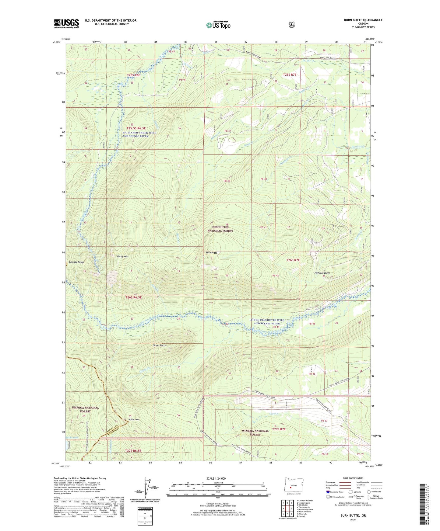
Burn Butte Oregon US Topo Map
Couldn't load pickup availability
Also explore the Burn Butte Forest Service Topo of this same quad for updated USFS data
2023 topographic map quadrangle Burn Butte in the state of Oregon. Scale: 1:24000. Based on the newly updated USGS 7.5' US Topo map series, this map is in the following counties: Klamath, Douglas. The map contains contour data, water features, and other items you are used to seeing on USGS maps, but also has updated roads and other features. This is the next generation of topographic maps. Printed on high-quality waterproof paper with UV fade-resistant inks.
Quads adjacent to this one:
West: Tolo Mountain
Northwest: Cowhorn Mountain
North: Crescent Lake
Northeast: Odell Butte
East: Muttonchop Butte
Southeast: Chemult
South: Miller Lake
Southwest: Mount Thielsen
This map covers the same area as the classic USGS quad with code o43121c8.
Contains the following named places: Basin Creek, Burn Butte, Burn Creek, Cappy Mountain, Clover Butte, Clover Creek, Dublin Creek, Fly Creek, Hemlock Butte, Little Deschutes Wild and Scenic River, Maidu Lake Recreation Site, Miller Mountain, Otter Creek, Rabbit Creek, ZIP Code: 97733