MyTopo
Myrtle Creek Oregon US Topo Map
Couldn't load pickup availability
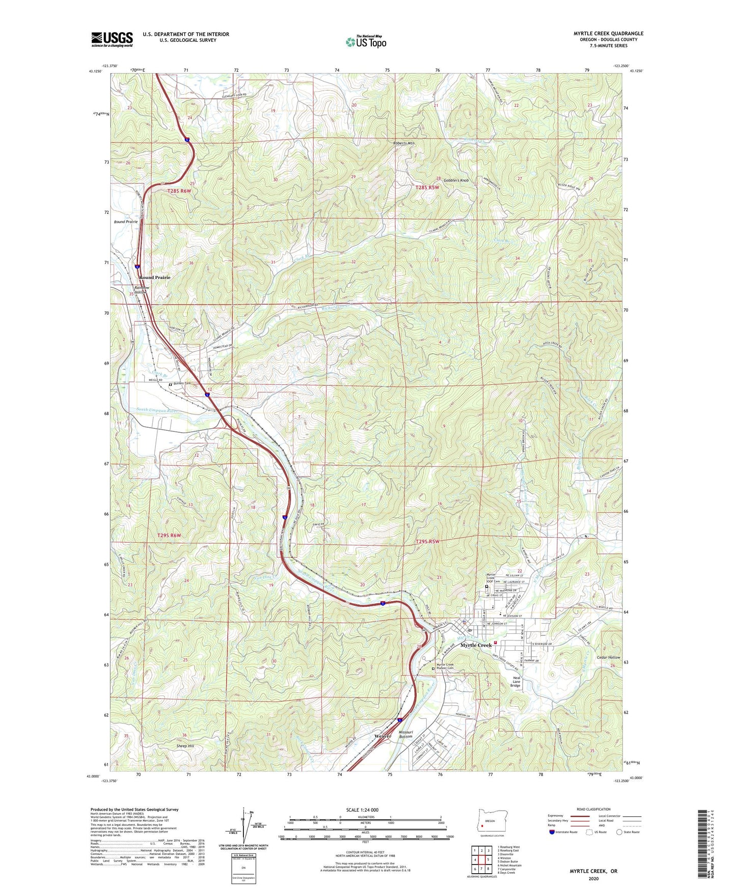
2020 topographic map quadrangle Myrtle Creek in the state of Oregon. Scale: 1:24000. Based on the newly updated USGS 7.5' US Topo map series, this map is in the following counties: Douglas. The map contains contour data, water features, and other items you are used to seeing on USGS maps, but also has updated roads and other features. This is the next generation of topographic maps. Printed on high-quality waterproof paper with UV fade-resistant inks.
Quads adjacent to this one:
West: Winston
Northwest: Roseburg West
North: Roseburg East
Northeast: Dixonville
East: Dodson Butte
Southeast: Days Creek
South: Canyonville
Southwest: Nickel Mountain
Contains the following named places: Bilger Creek, Boomer Hill School, Burnett Cemetery, Cedar Hollow, Church of the Nazarene, City of Myrtle Creek, Clark Branch, Clarks Branch Water Treatment Facility, Coffenberry Middle School, Dole, Douglas County Fire District 2 Station 8, Engles and Worth Log Pond, Gobblers Knob, Harrison Young Brook, Mary Moore Bridge, Millsite Park, Myrtle Creek, Myrtle Creek Branch Library, Myrtle Creek City Hall, Myrtle Creek Elementary School, Myrtle Creek Fire Department, Myrtle Creek IOOF Cemetery, Myrtle Creek Municipal Court, Myrtle Creek Pioneer Cemetery, Myrtle Creek Police Department, Myrtle Creek Post Office, Myrtle Creek Public Works, Myrtle Creek Sewage Treatment Plant, Myrtle Creek Springbrook Water Treatment Plant, Neal Lane Bridge, North Myrtle Creek, Richardson Creek, Roberts Mountain, Rock Creek, Round Prairie, Round Prairie Post Office, Ruckles, Ruckles Post Office, Seventh Day Adventist Church, Sheep Hill, South County Christian School, South Douglas Rodeo, South Myrtle Creek, South Umpqua Safety Rest Area, Van Dine Creek, Weaver, Weigle Landing