MyTopo
Roseburg West Oregon US Topo Map
Couldn't load pickup availability
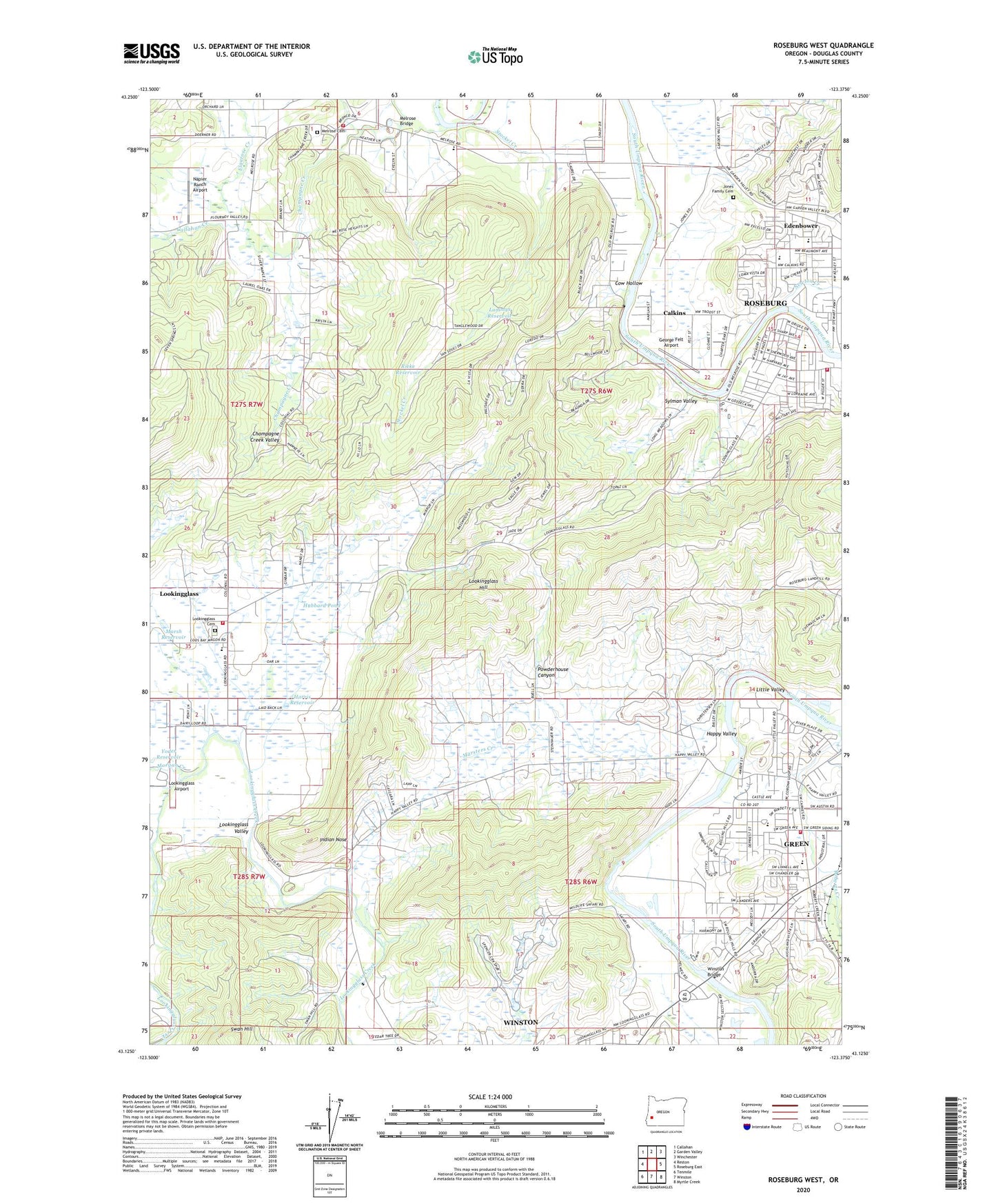
2023 topographic map quadrangle Roseburg West in the state of Oregon. Scale: 1:24000. Based on the newly updated USGS 7.5' US Topo map series, this map is in the following counties: Douglas. The map contains contour data, water features, and other items you are used to seeing on USGS maps, but also has updated roads and other features. This is the next generation of topographic maps. Printed on high-quality waterproof paper with UV fade-resistant inks.
Quads adjacent to this one:
West: Reston
Northwest: Callahan
North: Garden Valley
Northeast: Winchester
East: Roseburg East
Southeast: Myrtle Creek
South: Winston
Southwest: Tenmile
This map covers the same area as the classic USGS quad with code o43123b4.
Contains the following named places: Brown Park, Calkins, Callahan Creek, City of Roseburg Sewage Disposal Plant, Cow Hollow, Doerner Creek, Douglas County Fire District 2 Melrose Station, Douglas County Fire District 2 Station 2, Edenbower, Edenbower Post Office, Elgarose Creek, Eugene Log Pond, Fullerton Elementary School, George Felt Airport, Green Census Designated Place, Green District Sewage Disposal Ponds, Green Elementary School, Green Oaks County Park, Happy Valley, Happy Valley County Park Boat Ramp, Harris Reservoir, Hubbard Pond, Hucrest Elementary School, Indian Nose, Jones Family Cemetery, KYES-AM, Lammys Reservoir, Little Valley, Lookingglass, Lookingglass Cemetery, Lookingglass Census Designated Place, Lookingglass Elementary School, Lookingglass Hill, Lookingglass Post Office, Lookingglass Sanitary Transfer Station, Lookingglass Valley, Lookingglass Volunteer Fire Department, Marsh Reservoir, Marsters Creek, Melrose, Melrose Bridge, Melrose Cemetery, Melrose Elementary School, Melrose Post Office, Morgan Creek, Napier Ranch Airport, Newton Creek, North Fork Roberts Creek, Powderhouse Canyon, Quintus Park, Rieke Reservoir, Roberts Creek Water District, Roseburg Fire Department Station 2, Roseburg Junior Academy, Roseburg Sanitary Landfill, Roseburg Urban Sanitary Authority, Stockel Creek, Sunnyslope Elementary School, Swan Hill, Sweetbriar Creek, Sylman Valley, Umpqua Valley Christian School, Wanaville Post Office, Wardton, Wardton Post Office, Winston - Green Wastewater Treatment Plant, Winston Bridge, Yoder Reservoir, ZIP Code: 97471