MyTopo
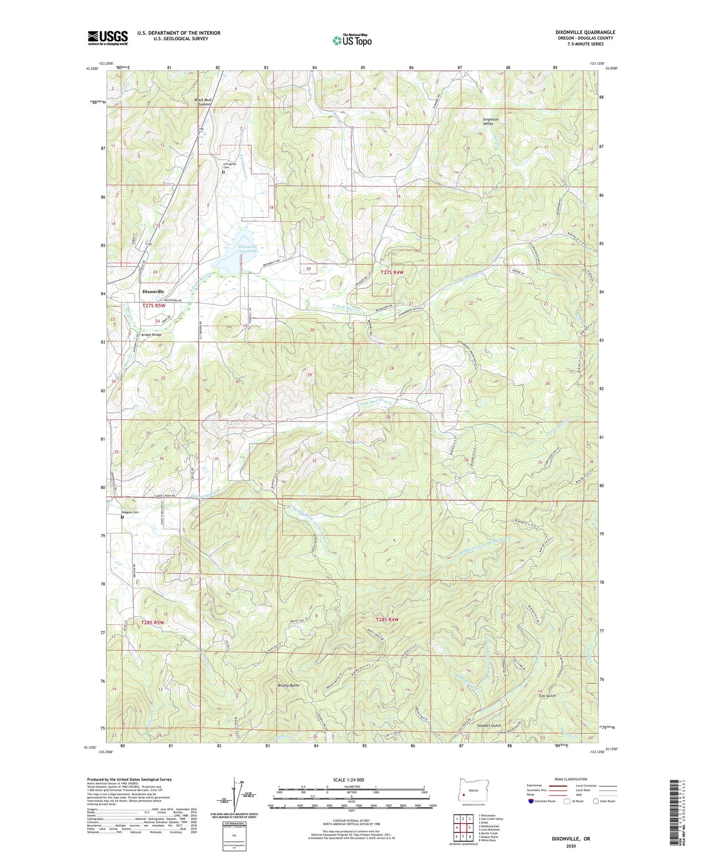
Dixonville Oregon US Topo Map
Couldn't load pickup availability
2023 topographic map quadrangle Dixonville in the state of Oregon. Scale: 1:24000. Based on the newly updated USGS 7.5' US Topo map series, this map is in the following counties: Douglas. The map contains contour data, water features, and other items you are used to seeing on USGS maps, but also has updated roads and other features. This is the next generation of topographic maps. Printed on high-quality waterproof paper with UV fade-resistant inks.
Quads adjacent to this one:
West: Roseburg East
Northwest: Winchester
North: Oak Creek Valley
Northeast: Glide
East: Lane Mountain
Southeast: White Rock
South: Dodson Butte
Southwest: Myrtle Creek
This map covers the same area as the classic USGS quad with code o43123b2.
Contains the following named places: Black Mud Summit, Boggess Cemetery, Brushy Butte, Dixonville, Dixonville Log Pond, Dixonville Log Pond Dam, Dixonville Post Office, East Fork High Prairie Creek, Hatfield, High Prairie Creek, Johnston Log Pond, Krogel Bridge, Livingston Cemetery, Livingston Creek, Lurley Post Office, Melton Creek, Middle Fork of South Fork Deer Creek, North Fork Deer Creek, O C Brown County Park, Rose Creek, South Deer Creek Grange, South Fork Deer Creek, Tucker Creek, West Fork High Prairie Creek