
MyTopo
Nonpareil Oregon US Topo Map
Couldn't load pickup availability
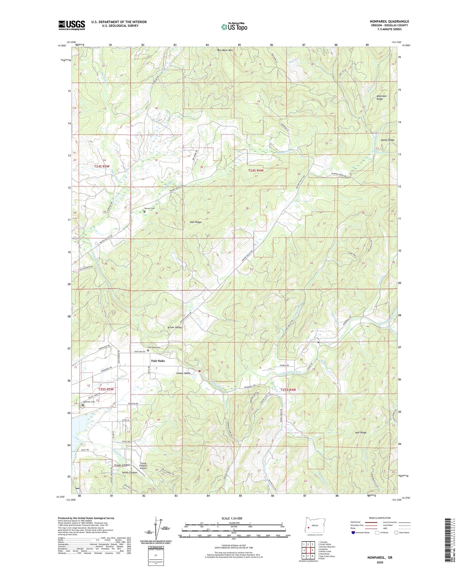
2020 topographic map quadrangle Nonpareil in the state of Oregon. Scale: 1:24000. Based on the newly updated USGS 7.5' US Topo map series, this map is in the following counties: Douglas. The map contains contour data, water features, and other items you are used to seeing on USGS maps, but also has updated roads and other features. This is the next generation of topographic maps. Printed on high-quality waterproof paper with UV fade-resistant inks.
Quads adjacent to this one:
West: Sutherlin
Northwest: Yoncalla
North: Scotts Valley
Northeast: Harness Mountain
East: Hinkle Creek
Southeast: Glide
South: Oak Creek Valley
Southwest: Winchester
Contains the following named places: Bachelor Creek, Banks Creek, Bonanza Mine, Boyd Creek, Cantell Creek, Denley Brothers Dam, Driver Valley, English Settlement, Fair Oaks, Fair Oaks Cemetery, Fair Oaks Census Designated Place, Fair Oaks County Park, Fair Oaks Post Office, Fair Oaks Rural Fire Protection District, Flying D Ranch Airport, Foster Creek, Fraser Canyon, Gassy Creek, Gossett Creek, Hall Ridge, Haney Creek, Harvey Cemetery, Long Valley Creek, Markham Creek, Mill Creek, Nonpareil, Nonpareil Mine, Nonpareil Post Office, Norris Creek, Pelland Creek, Platt 1 Reservoir, Robinson Ridge, Salt Lick Creek, Smith Canyon, Sutherlin Cemetery, Sutherlin Nonpareil Water Treatment Plant, ZIP Code: 97479


