MyTopo
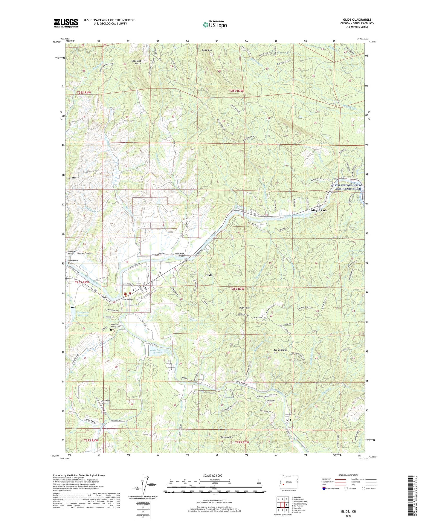
Glide Oregon US Topo Map
Couldn't load pickup availability
Also explore the Glide Forest Service Topo of this same quad for updated USFS data
2023 topographic map quadrangle Glide in the state of Oregon. Scale: 1:24000. Based on the newly updated USGS 7.5' US Topo map series, this map is in the following counties: Douglas. The map contains contour data, water features, and other items you are used to seeing on USGS maps, but also has updated roads and other features. This is the next generation of topographic maps. Printed on high-quality waterproof paper with UV fade-resistant inks.
Quads adjacent to this one:
West: Oak Creek Valley
Northwest: Nonpareil
North: Hinkle Creek
Northeast: Harrington Creek
East: Old Fairview
Southeast: Red Butte
South: Lane Mountain
Southwest: Dixonville
This map covers the same area as the classic USGS quad with code o43123c1.
Contains the following named places: Ace Williams Mountain, Bradley Creek, Britt Creek, Buck Rock, Buckhorn Creek, Colliding Rivers County Park Boat Ramp, Colliding Rivers Park, Copeland Butte, Engels Creek, Fall Creek, Floyd Frear Bridge, French Creek, Glide, Glide - Idleyld Sanitary District, Glide Aero Airport, Glide Bridge, Glide Census Designated Place, Glide Community Hall, Glide Elementary School, Glide High School, Glide Junction, Glide Middle School, Glide Post Office, Glide Rural Fire Protection District, Glide Upper Elementary School, Hoaglin, Hoaglin Post Office, Hog Mountain, Hughes Canyon, Idleyld Park, Idleyld Park Post Office, King Creek, Little River, Little River Log Dam, Little River Log Pond, Lone Rock Bridge, Lone Rock Camp, Lone Rock Wayside County Park, Lone Rock Wayside County Park Boat Launch, North Umpqua Ranger Station, Old Hatchery Creek, Pattersons Mills, Pattersons Mills Post Office, Peel, Peel Post Office, Rattlesnake Creek, Rock Creek, Rock Creek Fish Hatchery, Rock Creek Guard Station, Rockland, Scott Mountain, Seventh-Day Adventist Church, The Narrows, Tioga Post Office, United States Forest Service North Umpqua Ranger District, Updegrave Dam, Updegrave Reservoir, Watson Mountain, West Fork Britt Creek, Williams Creek, Wimberly Family Cemetery, ZIP Code: 97443