MyTopo
Oxbow Oregon US Topo Map
Couldn't load pickup availability
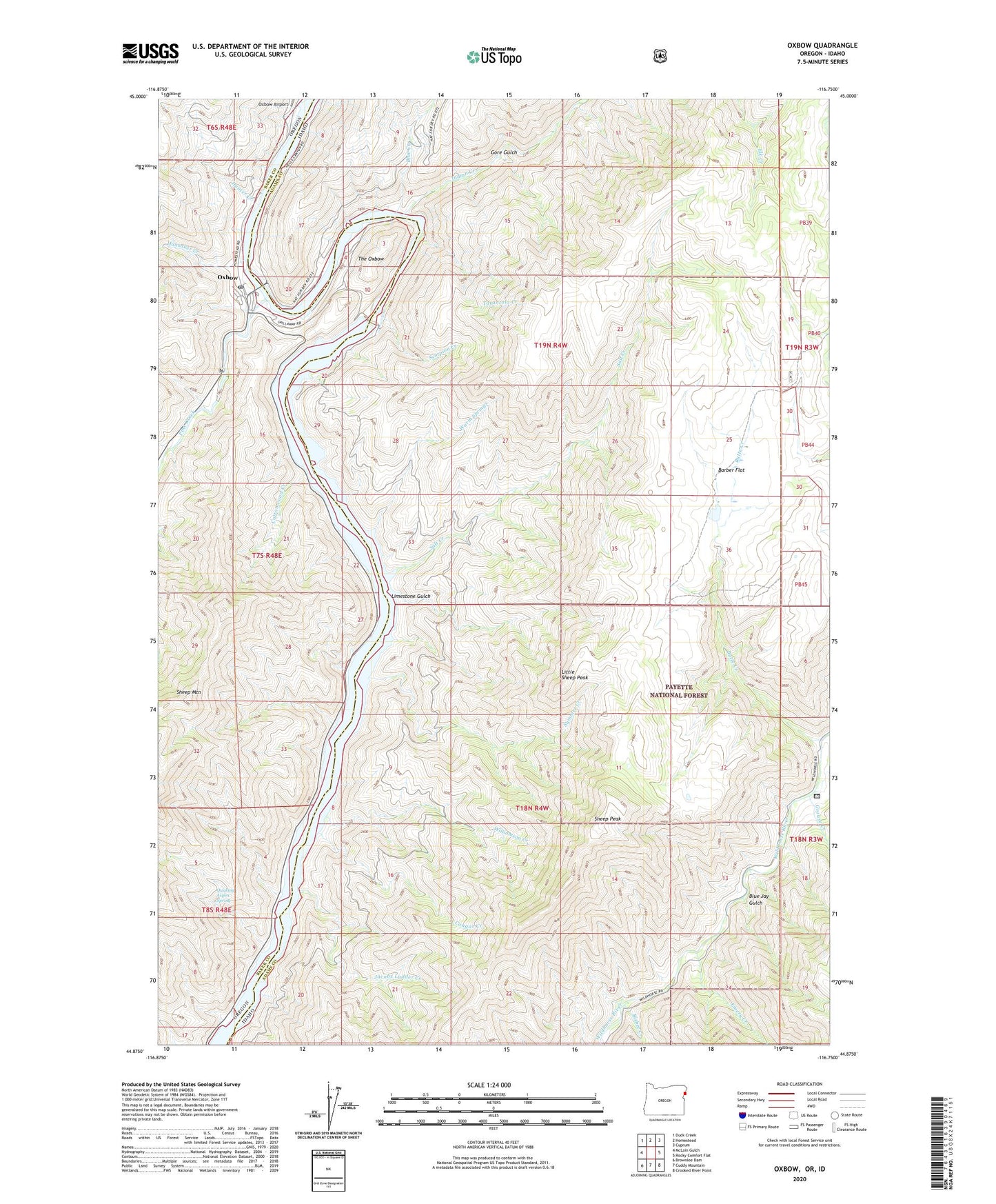
2020 topographic map quadrangle Oxbow in the states of Idaho, Oregon. Scale: 1:24000. Based on the newly updated USGS 7.5' US Topo map series, this map is in the following counties: Baker, Adams. The map contains contour data, water features, and other items you are used to seeing on USGS maps, but also has updated roads and other features. This is the next generation of topographic maps. Printed on high-quality waterproof paper with UV fade-resistant inks.
Quads adjacent to this one:
West: McLain Gulch
Northwest: Duck Creek
North: Homestead
Northeast: Cuprum
East: Rocky Comfort Flat
Southeast: Crooked River Point
South: Cuddy Mountain
Southwest: Brownlee Dam
Contains the following named places: Barber Flat, Bisbee Creek, Blue Creek, Blue Jay Gulch, Butte Creek, Copperfield Boat Ramp, Copperfield Campground, Cottonwood Creek, Cougar Creek, Emery Creek, Gore Gulch, Grouse Creek, Hunsaker Creek, Hunter Creek, Indian Creek, Jacobs Ladder Creek, Limestone Gulch, Little Sheep Peak, Macfer, Oxbow, Oxbow Boat Dock, Oxbow Dam, Oxbow Post Office, Oxbow Reservoir, Oxbow School, Pine Creek, Quaking Aspen Spring, Salt Creek, Scorpion Creek, Sheep Mountain, Sheep Peak, Summer Creek, Tarantula Creek, The Oxbow, Warm Springs Creek, Williamson Creek