MyTopo
Homestead Montana US Topo Map
Couldn't load pickup availability
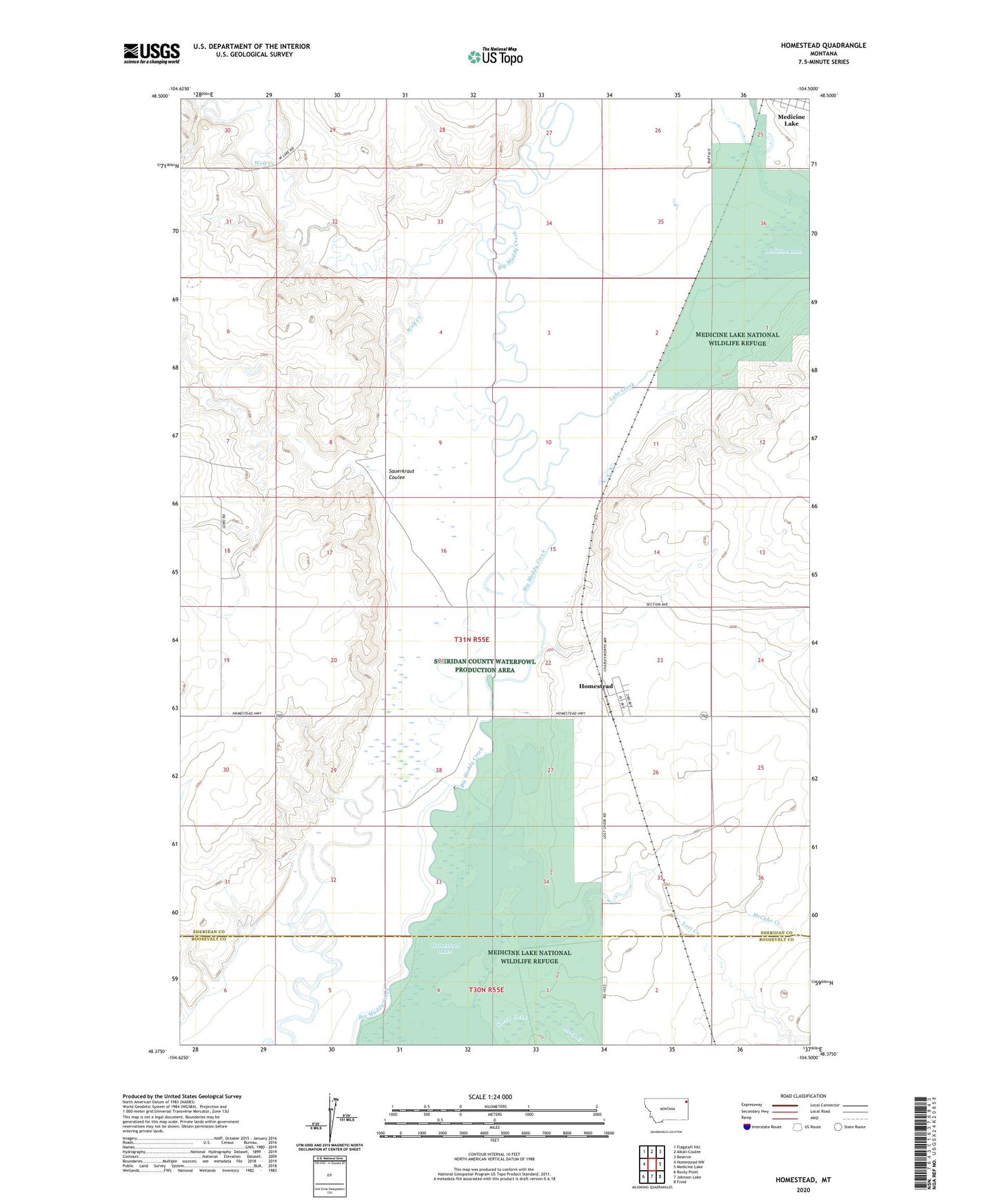
2024 topographic map quadrangle Homestead in the state of Montana. Scale: 1:24000. Based on the newly updated USGS 7.5' US Topo map series, this map is in the following counties: Sheridan, Roosevelt. The map contains contour data, water features, and other items you are used to seeing on USGS maps, but also has updated roads and other features. This is the next generation of topographic maps. Printed on high-quality waterproof paper with UV fade-resistant inks.
Quads adjacent to this one:
West: Homestead NW
Northwest: Flagstaff Hill
North: Alkali Coulee
Northeast: Reserve
East: Medicine Lake
Southeast: Froid
South: Johnson Lake
Southwest: Rocky Point
This map covers the same area as the classic USGS quad with code o48104d5.
Contains the following named places: 29N56E04CDB_01 Well, 30N55E01BAB_01 Well, 30N55E03AAAA01 Well, 31N55E18DBAB01 Well, 31N55E23DCCD01 Well, 31N55E29AABD01 Well, 31N55E35CBDB01 Well, Dam Number 4, Dam Number 6, Farmers Elevator Company of Froid, First Lutheran Church, Homestead, Homestead Census Designated Place, Homestead Elevator, Homestead High School, Homestead Lake, Homestead Post Office, Lake Creek, Lost Creek, McCabe Creek, Medicine Lake Refuge Number 4 Dam, Medicine Structure Dam, Miller School, Nazarene Church, Sauerkraut Coulee, Wolf Creek