MyTopo
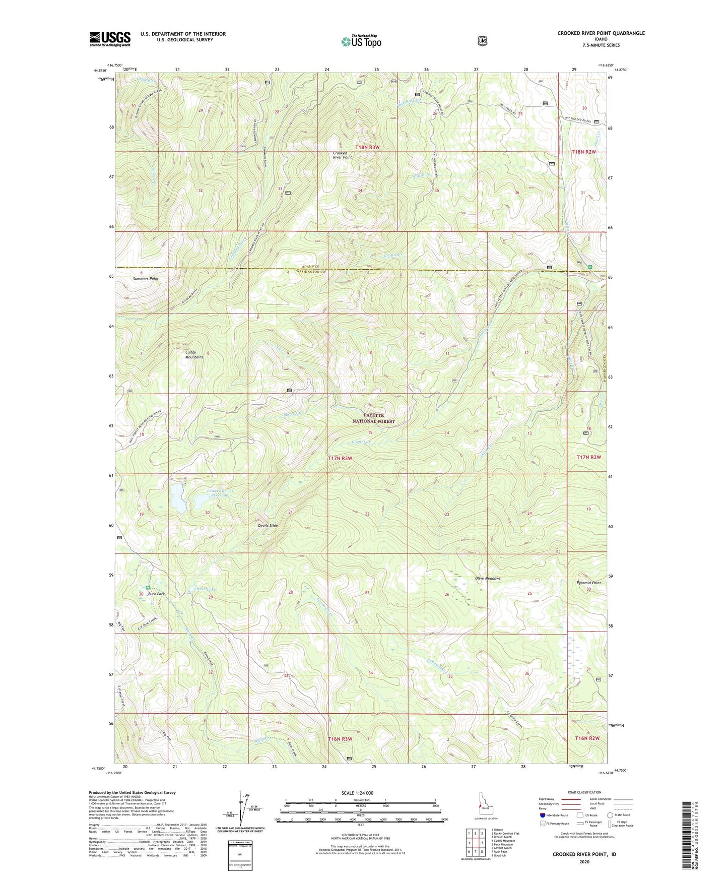
Crooked River Point Idaho US Topo Map
Couldn't load pickup availability
Also explore the Crooked River Point Forest Service Topo of this same quad for updated USFS data
2024 topographic map quadrangle Crooked River Point in the state of Idaho. Scale: 1:24000. Based on the newly updated USGS 7.5' US Topo map series, this map is in the following counties: Washington, Adams. The map contains contour data, water features, and other items you are used to seeing on USGS maps, but also has updated roads and other features. This is the next generation of topographic maps. Printed on high-quality waterproof paper with UV fade-resistant inks.
Quads adjacent to this one:
West: Cuddy Mountain
Northwest: Oxbow
North: Rocky Comfort Flat
Northeast: Weasel Gulch
East: Peck Mountain
Southeast: Goodrich
South: Rush Peak
Southwest: Advent Gulch
This map covers the same area as the classic USGS quad with code o44116g6.
Contains the following named places: Buck Park, Buck park Guard Station, Crooked River Point, Cuddy Mine, Devils Slide, Grouse Creek, Hornet Creek-Lower Dam, Hornet Creek-Upper Dam, Hornet Ranger Station, Hornet Reservoir, Johnson Creek Park, Lower Hornet Reservoir, North Creek, Olive Creek, Olive Meadows, Placer Creek, Pyramid Point, Rush Lake, Summers Point, West Mill Creek