
MyTopo
Pelican Bay Oregon US Topo Map
Couldn't load pickup availability
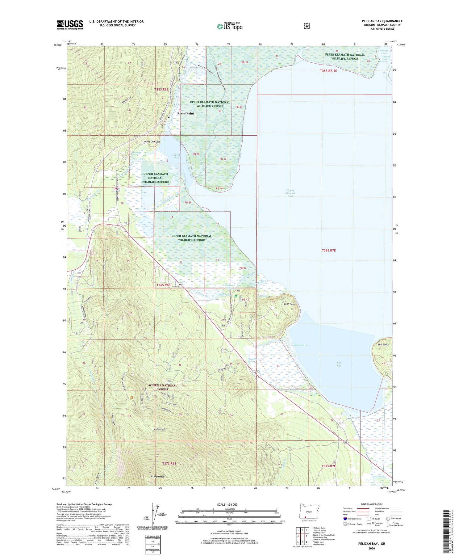
2020 topographic map quadrangle Pelican Bay in the state of Oregon. Scale: 1:24000. Based on the newly updated USGS 7.5' US Topo map series, this map is in the following counties: Klamath. The map contains contour data, water features, and other items you are used to seeing on USGS maps, but also has updated roads and other features. This is the next generation of topographic maps. Printed on high-quality waterproof paper with UV fade-resistant inks.
Quads adjacent to this one:
West: Lake of the Woods North
Northwest: Pelican Butte
North: Crystal Spring
Northeast: Agency Lake
East: Shoalwater Bay
Southeast: Howard Bay
South: Aspen Lake
Southwest: Lake of the Woods South
Contains the following named places: Ball Bay, Ball Point, Bud Spring, Camporee Spring, Coon Point, Crystal Creek, Denny Creek Historic Monument, Doaks Marsh, Fourmile Creek, Harriman Lodge, Harriman Rural Fire Department, Harriman Spring, Keno Division, Klamath County Dump, Long Rifle Cinder Pit, Moss Creek, Mountain Lakes Organizational Camp, Odessa Campground Boat Launch, Odessa Cinder Pit, Odessa Creek, Odessa Post Office, Odessa Recreation Site, Odessa Spring, Pelican Bay, Pelican Cinder Pit, Pelican Cut Canal, Pelican Fire Guard Station, Pelican Forest Service Station, Point Comfort, Recreation, Recreation Creek, Recreation Post Office, Rocky Point, Rocky Point Census Designated Place, Rocky Point Fire and Emergency Medical Services, Rocky Point Post Office, Rocky Point Recreation Site, Rocky Point Resort Boat Launch, Short Creek, Thomason Creek, Tomahawk Ski Bowl, Varney Creek, Varney Creek Trail, Wampler Marsh, Wampler Spring, ZIP Code: 97601


