MyTopo
Shoalwater Bay Oregon US Topo Map
Couldn't load pickup availability
Also explore the Shoalwater Bay Forest Service Topo of this same quad for updated USFS data
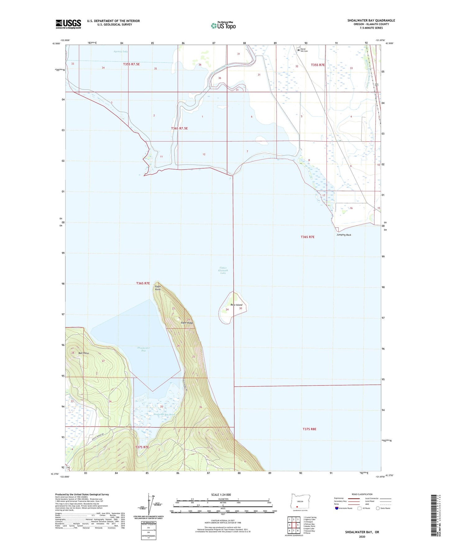
2024 topographic map quadrangle Shoalwater Bay in the state of Oregon. Scale: 1:24000. Based on the newly updated USGS 7.5' US Topo map series, this map is in the following counties: Klamath. The map contains contour data, water features, and other items you are used to seeing on USGS maps, but also has updated roads and other features. This is the next generation of topographic maps. Printed on high-quality waterproof paper with UV fade-resistant inks.
Quads adjacent to this one:
West: Pelican Bay
Northwest: Crystal Spring
North: Agency Lake
Northeast: Chiloquin
East: Modoc Point
Southeast: Wocus
South: Howard Bay
Southwest: Aspen Lake
This map covers the same area as the classic USGS quad with code o42121d8.
Contains the following named places: Bare Island, David Hill Cemetery, Eagle Point, Eagle Ridge, Eagle Ridge Boat Launch, Eagle Ridge County Park, Jumping Rock, Rock Creek Ranch, Shoalwater Bay, Shoalwater Bay Marsh, Upper Klamath Lake, Williamson River