MyTopo
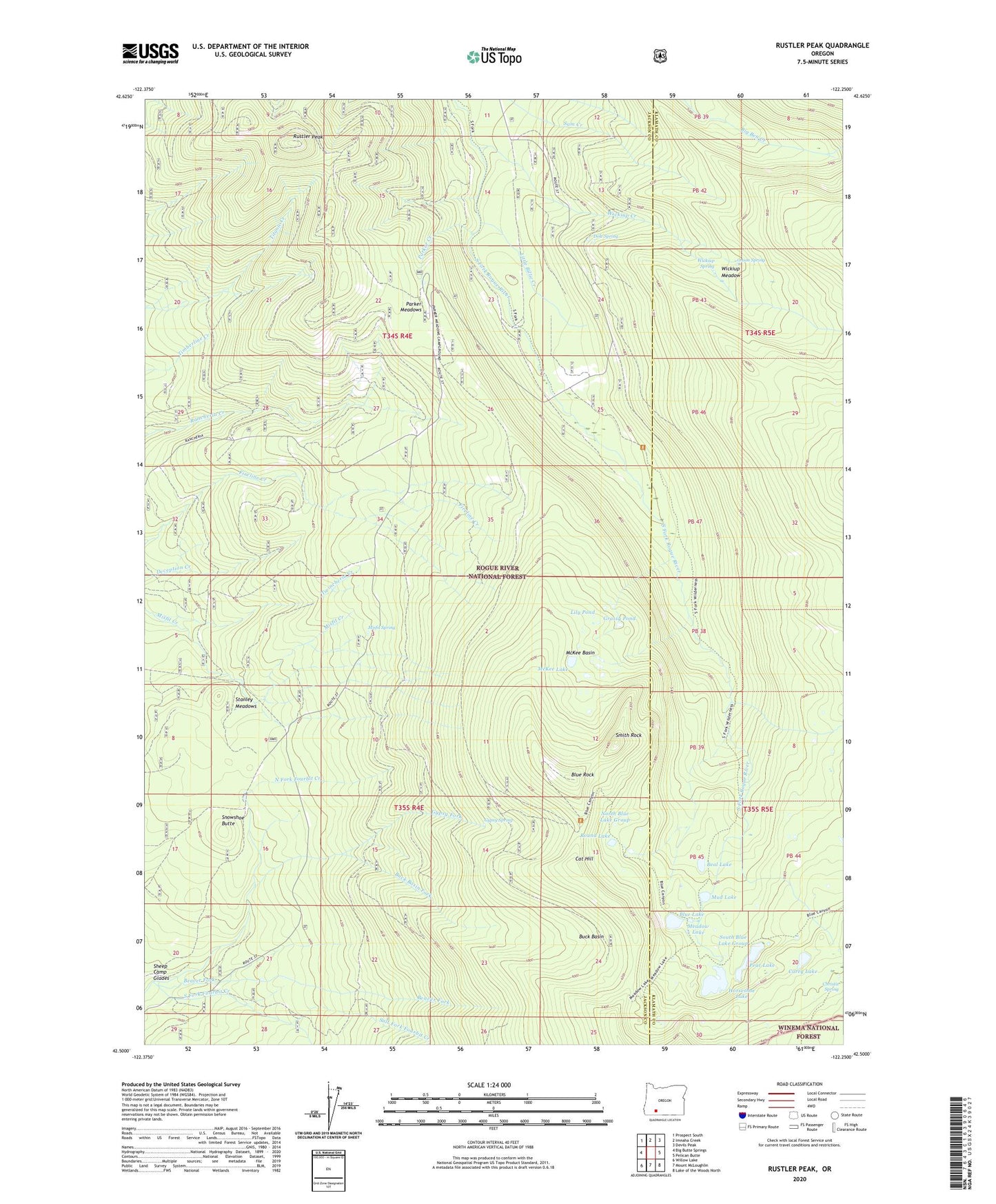
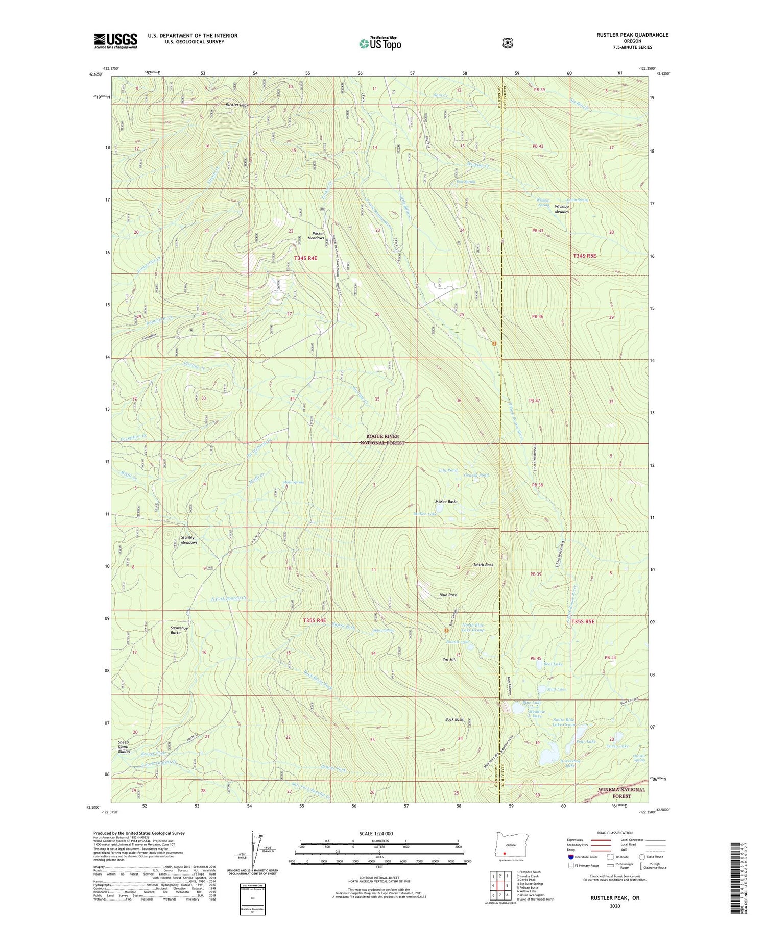
Rustler Peak Oregon US Topo Map
Couldn't load pickup availability
2020 topographic map quadrangle Rustler Peak in the state of Oregon. Scale: 1:24000. Based on the newly updated USGS 7.5' US Topo map series, this map is in the following counties: Jackson, Klamath. The map contains contour data, water features, and other items you are used to seeing on USGS maps, but also has updated roads and other features. This is the next generation of topographic maps. Printed on high-quality waterproof paper with UV fade-resistant inks.
Quads adjacent to this one:
West: Big Butte Springs
Northwest: Prospect South
North: Imnaha Creek
Northeast: Devils Peak
East: Pelican Butte
Southeast: Lake of the Woods North
South: Mount McLoughlin
Southwest: Willow Lake
Contains the following named places: Beal Lake, Beaver Fork, Blue Canyon Lake, Blue Canyon Trail, Blue Lake, Blue Lake Camp, Blue Rock, Buck Basin, Buck Basin Fork, Carey Lake, Carney Lake Camp, Cat Hill, Cat Hill Way, Christis Spring, Dole Spring, Goss Trail, Grassy Pond, Gypsy Fork, Gypsy Spring, Horseshoe Lake, Lily Pond, Little Billie Creek, Little Butte Creek, McKee Basin, McKee Lake, Meadow Lake, Meadow Lake Camp, Misfit Creek, Misfit Spring, Mud Lake, North Blue Lake Group, North Fork Fourbit Creek, Onion Spring, Parker Creek, Parker Meadows, Parker Meadows Recreation Site, Pear Lake, Pear Lake Camp, Pioneer Post Office, Rogue Head Camp, Round Lake, Rustler Peak, Saddle Campground, Salt Fork Fourbit Creek, Sheep Camp, Sheep Camp Glades, Smith Rock, Snowshoe Butte, Snowshoe Forest Camp, South Blue Lake Group, South Fork Fourbit Creek, South Fork Trail, Stanley Meadows, Upper South Fork Campground, Wickiup Creek, Wickiup Forest Camp, Wickiup Meadow, Wickiup Shelter, Wickiup Spring