MyTopo
Prospect South Oregon US Topo Map
Couldn't load pickup availability
Also explore the Prospect South Forest Service Topo of this same quad for updated USFS data
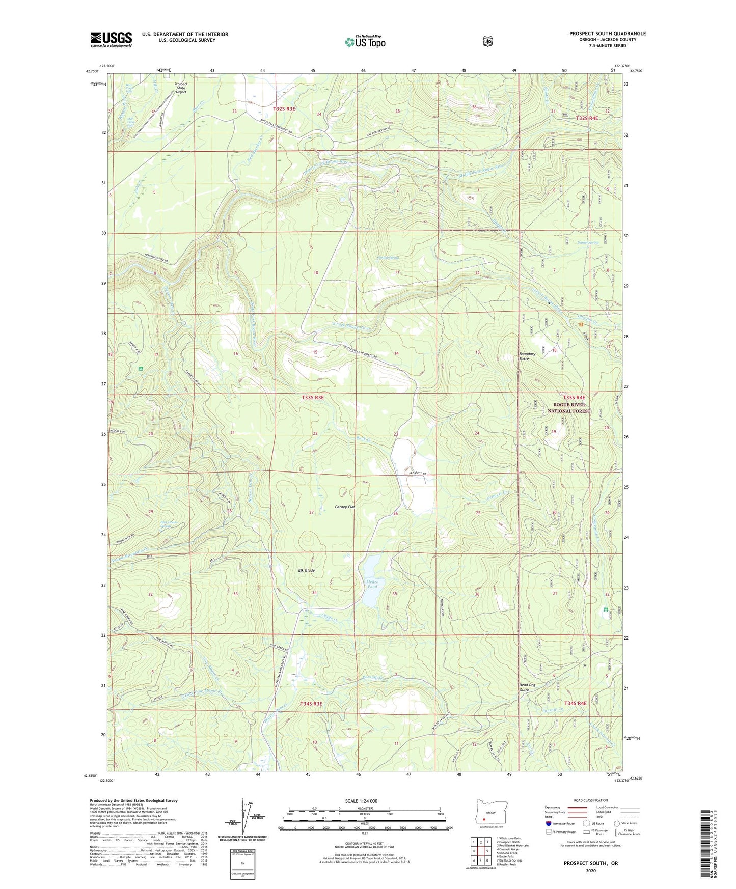
2023 topographic map quadrangle Prospect South in the state of Oregon. Scale: 1:24000. Based on the newly updated USGS 7.5' US Topo map series, this map is in the following counties: Jackson. The map contains contour data, water features, and other items you are used to seeing on USGS maps, but also has updated roads and other features. This is the next generation of topographic maps. Printed on high-quality waterproof paper with UV fade-resistant inks.
Quads adjacent to this one:
West: Cascade Gorge
Northwest: Whetstone Point
North: Prospect North
Northeast: Red Blanket Mountain
East: Imnaha Creek
Southeast: Rustler Peak
South: Big Butte Springs
Southwest: Butte Falls
This map covers the same area as the classic USGS quad with code o42122f4.
Contains the following named places: Aiken County Park, Ash Creek, Barr Creek, Barr Creek Falls, Beaver Dam Creek, Bessie Creek, Blue Goose Spring, Boundary Butte, Buck Creek, Butte Falls-Prospect Division, Carney Flat, Cod Creek, Conley Spring, Copco Powerhouse, Crane Creek, Cur Creek, Dailey Dam, Daniel Creek, Daniel Spring, Dead Dog Gulch, Elk Glade, Geppert Creek, Gyppo Creek, Imnaha Creek, Lodgepole Guard Station, Medco Pond, Middle Fork Canyon, Middle Fork Parsnip Creek, Middle Fork Rogue River, Mill Creek, Mill Creek Falls, Mill-Mar Ranch, Oakridge School, Parsnip Creek, Prospect Powerhouse, Prospect State Airport, Prospect State Park, Red Blanket Creek, Reinecke Burn, Round Mountain Creek, South Fork Dam, South Fork Parsnip Creek, South Fork Vine Maple Creek, Svinth Creek, Twentynine Creek, Vine Maple Creek, Zimmerman Burn