MyTopo
Sager Creek Oregon US Topo Map
Couldn't load pickup availability
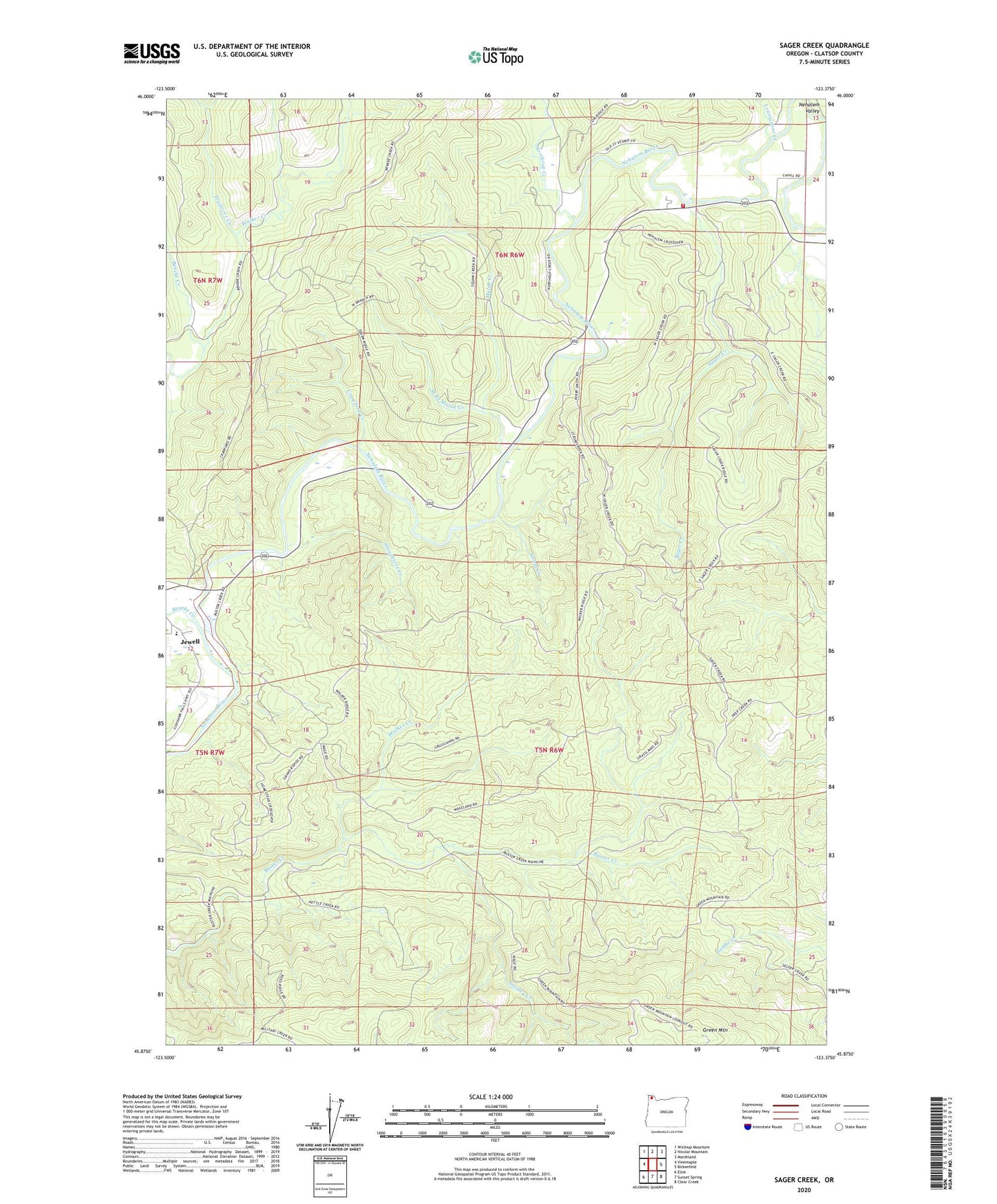
2020 topographic map quadrangle Sager Creek in the state of Oregon. Scale: 1:24000. Based on the newly updated USGS 7.5' US Topo map series, this map is in the following counties: Clatsop. The map contains contour data, water features, and other items you are used to seeing on USGS maps, but also has updated roads and other features. This is the next generation of topographic maps. Printed on high-quality waterproof paper with UV fade-resistant inks.
Quads adjacent to this one:
West: Vinemaple
Northwest: Wickiup Mountain
North: Nicolai Mountain
Northeast: Marshland
East: Birkenfeld
Southeast: Clear Creek
South: Sunset Spring
Southwest: Elsie
Contains the following named places: Beneke Creek, Buster Camp, Buster Creek Quarry, Crawford Creek, Doctor Rankins Place, Green Mountain, Hopkins, Hopkins Post Office, Jewell School, Kale Creek, Lousignont Creek, Mist - Birkenfeld Fire Department Sager, Mulak Creek, Northrup Creek, Sager Creek, Slaughters Creek, Stanley Creek, Strum Creek, Trailover Creek, Vesper Post Office, Walker Creek, West Branch Mulak Creek