MyTopo
Birkenfeld Oregon US Topo Map
Couldn't load pickup availability
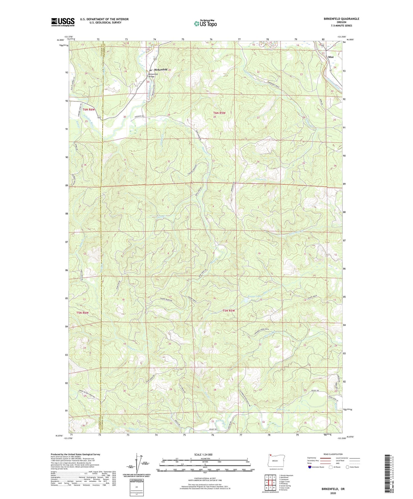
2023 topographic map quadrangle Birkenfeld in the state of Oregon. Scale: 1:24000. Based on the newly updated USGS 7.5' US Topo map series, this map is in the following counties: Columbia, Clatsop. The map contains contour data, water features, and other items you are used to seeing on USGS maps, but also has updated roads and other features. This is the next generation of topographic maps. Printed on high-quality waterproof paper with UV fade-resistant inks.
Quads adjacent to this one:
West: Sager Creek
Northwest: Nicolai Mountain
North: Marshland
Northeast: Clatskanie
East: Pittsburg
Southeast: Vernonia
South: Clear Creek
Southwest: Sunset Spring
This map covers the same area as the classic USGS quad with code o45123h3.
Contains the following named places: Birkenfeld, Birkenfeld Bridge, Birkenfeld Post Office, Cougar Creek, David Creek, Deep Creek, Early, Fishhawk Creek, Grub Creek, Homewood, Ivy Creek, Kauppi Lake, Lane Creek, Lundgren Creek, Mist, Mist Post Office, Nelson Creek, Neverstil Post Office, Neverstill, Pivot Post Office, Selder Creek, Tara, Vesper, Vesper School, Zan