MyTopo
Clear Creek Oregon US Topo Map
Couldn't load pickup availability
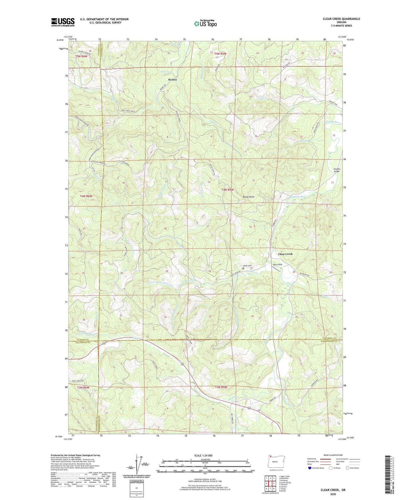
2023 topographic map quadrangle Clear Creek in the state of Oregon. Scale: 1:24000. Based on the newly updated USGS 7.5' US Topo map series, this map is in the following counties: Columbia, Washington, Clatsop, Tillamook. The map contains contour data, water features, and other items you are used to seeing on USGS maps, but also has updated roads and other features. This is the next generation of topographic maps. Printed on high-quality waterproof paper with UV fade-resistant inks.
Quads adjacent to this one:
West: Sunset Spring
Northwest: Sager Creek
North: Birkenfeld
Northeast: Pittsburg
East: Vernonia
Southeast: Buxton
South: Timber
Southwest: Cochran
This map covers the same area as the classic USGS quad with code o45123g3.
Contains the following named places: Arcadia Bridge, Bero Field, Cedar Creek, Clear Creek, Clear Creek Post Office, Coal Creek, County Line, Eastman, Fall Creek, Ginger Creek, Green Timber Creek, Keasey, Keasey Post Office, Kist Creek, Kist Post Office, Lausman, Logspur, Lousignont Creek, Lower North Fork, Maynard Creek, North Cemetery of Clear Creek, North Fork Green Timber Creek, North Fork Wolf Creek, Robinson Creek, Rock Creek, Rocky Point, South Fork Clear Creek, South Fork Green Timber Creek, South Prong Clear Creek, Sunset Camp, Timber Substation, Upper North Fork, Weed Creek, Wolf Creek