MyTopo
Sand Rock Oregon US Topo Map
Couldn't load pickup availability
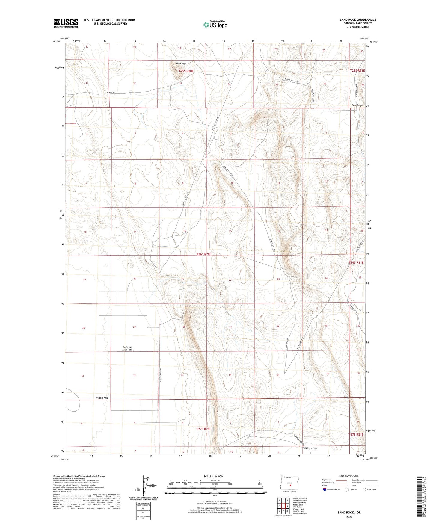
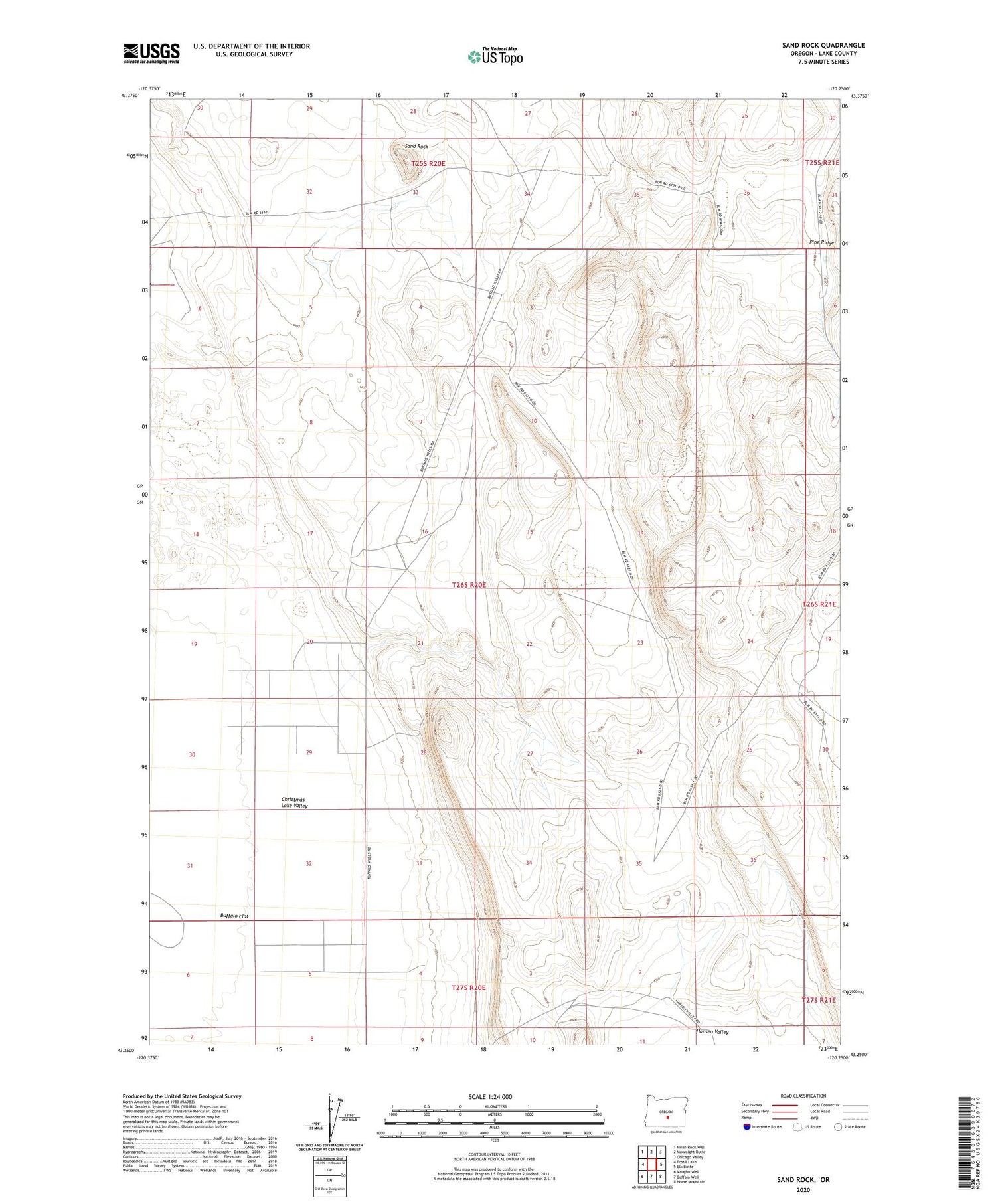
2020 topographic map quadrangle Sand Rock in the state of Oregon. Scale: 1:24000. Based on the newly updated USGS 7.5' US Topo map series, this map is in the following counties: Lake. The map contains contour data, water features, and other items you are used to seeing on USGS maps, but also has updated roads and other features. This is the next generation of topographic maps. Printed on high-quality waterproof paper with UV fade-resistant inks.
Quads adjacent to this one:
West: Fossil Lake
Northwest: Mean Rock Well
North: Moonlight Butte
Northeast: Chicago Valley
East: Elk Butte
Southeast: Horse Mountain
South: Buffalo Well
Southwest: Vaughn Well
Contains the following named places: Buffalo Flat, Pine Ridge, Sand Rock