MyTopo
Sheep Creek Divide Oregon US Topo Map
Couldn't load pickup availability
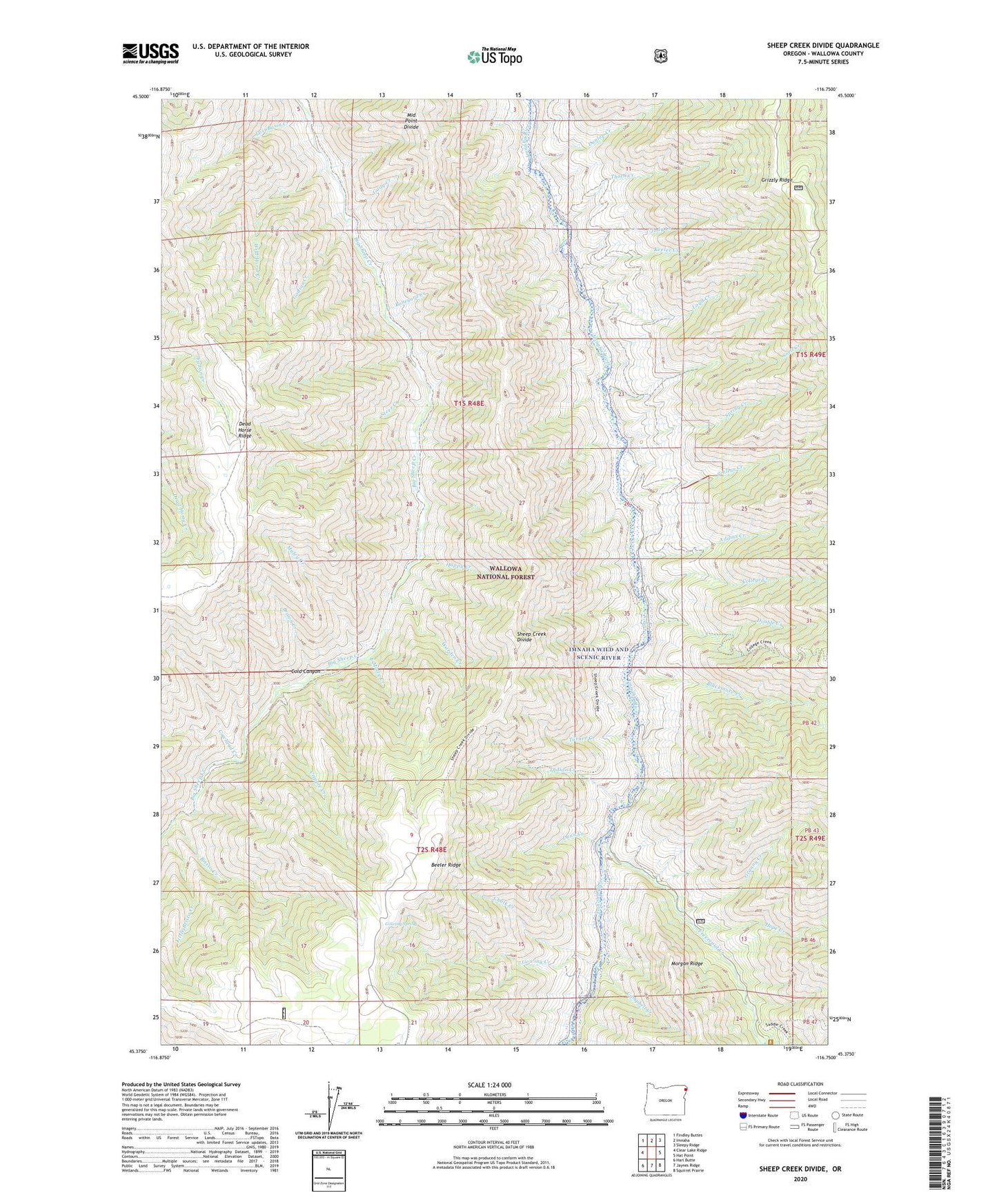
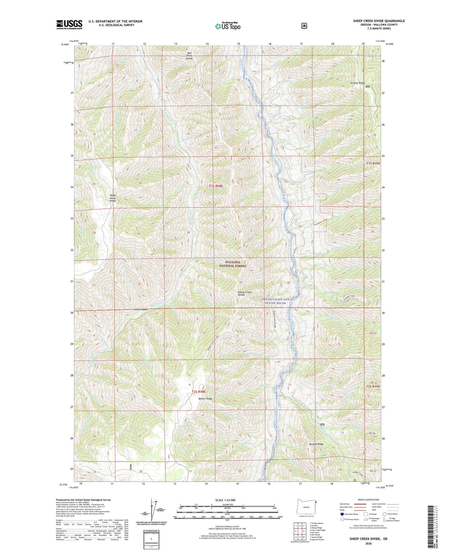
2020 topographic map quadrangle Sheep Creek Divide in the state of Oregon. Scale: 1:24000. Based on the newly updated USGS 7.5' US Topo map series, this map is in the following counties: Wallowa. The map contains contour data, water features, and other items you are used to seeing on USGS maps, but also has updated roads and other features. This is the next generation of topographic maps. Printed on high-quality waterproof paper with UV fade-resistant inks.
Quads adjacent to this one:
West: Clear Lake Ridge
Northwest: Findley Buttes
North: Imnaha
Northeast: Sleepy Ridge
East: Hat Point
Southeast: Squirrel Prairie
South: Jaynes Ridge
Southwest: Harl Butte
Contains the following named places: Adams Creek, Beeler Ridge, Blackmore Creek, Boneyard Creek, Bristo Creek, Brown Creek, Campbell Creek, Chalk Creek, Cold Canyon, College Creek, College Creek Ranger Station, Cowhead Creek, Cripple Creek, Dead Horse Ridge, Double Creek, Dunlap Creek, Dunn Creek, East Muley Creek, Freezeout Creek, Freezeout School, Freezeout Trailhead, Gaily Creek, Godias Creek, Gowing Creek, Gowing Spring, Granny Creek, Happy Creek, Hope Creek, Imnaha Wild and Scenic River, Indian Creek, Jody Creek, Keeler Creek, Little Bristo Creek, Lost Basin Creek, Loyd Creek, Middle Point Divide, Muley Creek, Schleur Creek, Sheep Creek Divide, Snell Creek, Spring Creek, Steer Creek, Thorn Creek, Turner Creek, Warden Creek, Wild Horse Creek, Wilde Ranch