MyTopo
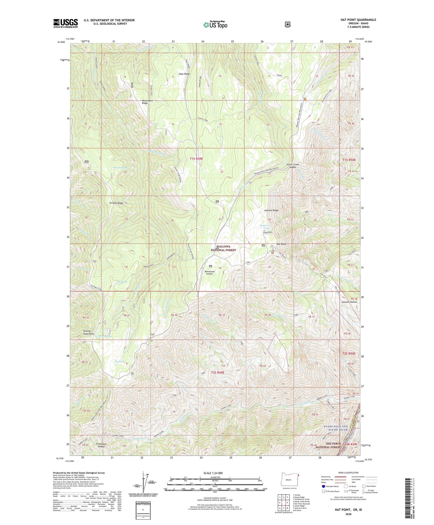
Hat Point Oregon US Topo Map
Couldn't load pickup availability
Also explore the Hat Point Forest Service Topo of this same quad for updated USFS data
2024 topographic map quadrangle Hat Point in the state of Oregon. Scale: 1:24000. Based on the newly updated USGS 7.5' US Topo map series, this map is in the following counties: Wallowa, Idaho. The map contains contour data, water features, and other items you are used to seeing on USGS maps, but also has updated roads and other features. This is the next generation of topographic maps. Printed on high-quality waterproof paper with UV fade-resistant inks.
Quads adjacent to this one:
West: Sheep Creek Divide
Northwest: Imnaha
North: Sleepy Ridge
Northeast: Temperance Creek
East: Old Timer Mountain
Southeast: He Devil
South: Squirrel Prairie
Southwest: Jaynes Ridge
This map covers the same area as the classic USGS quad with code o45116d6.
Contains the following named places: Audison Creek, Big Creek, East Fork Horse Creek, Freezeout Saddle, Granny Spring, Granny View Forest Service Station, Granny View Point, Granny View Recreation Site, Grizzly Ridge, Haas Ridge, Hat Point, Hat Point Lookout Tower, Hat Point Recreation Site, Helitack Base, High Trail, Hoodoo Spring, Horse Creek Cabin, Horse Creek Viewpoint, Indian Grave Creek, Jim Spring, Log Creek, Memaloose Airport, Memaloose Guard Station, Monument Ridge, Mud Spring, Rough Creek, Sacajawea Recreation Site, Sacajawea Spring, Saddle Creek Recreation Site, Sluice Creek Saddle, Summit Ridge, Twobuck Creek, Upper Snake River Trail, Warnock Corral, Warnock Corral Trailhead, Western Rim National Recreation Trail, ZIP Code: 97842