MyTopo
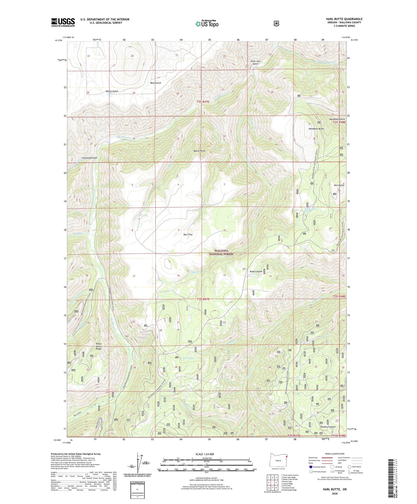
Harl Butte Oregon US Topo Map
Couldn't load pickup availability
Also explore the Harl Butte Forest Service Topo of this same quad for updated USFS data
2023 topographic map quadrangle Harl Butte in the state of Oregon. Scale: 1:24000. Based on the newly updated USGS 7.5' US Topo map series, this map is in the following counties: Wallowa. The map contains contour data, water features, and other items you are used to seeing on USGS maps, but also has updated roads and other features. This is the next generation of topographic maps. Printed on high-quality waterproof paper with UV fade-resistant inks.
Quads adjacent to this one:
West: Kinney Lake
Northwest: Three Lakes Country
North: Clear Lake Ridge
Northeast: Sheep Creek Divide
East: Jaynes Ridge
Southeast: Puderbaugh Ridge
South: Gumboot Butte
Southwest: Lick Creek
This map covers the same area as the classic USGS quad with code o45116c8.
Contains the following named places: Armin, Armin Post Office, Bunch Point, Carrol Creek, Coyote Creek, Cumming Gulch, Dixie Jett Gulch, Double Hitch Spring, East waqimataw Creek, Griffith Creek, Harl Butte, Harl Butte Lookout, Marr Creek, Marr Flat, Marr Flat Cow Camp, Morgan Creek, Needham Butte, Needham Creek, North Fork Carrol Creek, Road Creek, South waqimataw Creek, Spoon Spring, Timber Creek, Waqimataw Creek