MyTopo
Sixteen Butte Oregon US Topo Map
Couldn't load pickup availability
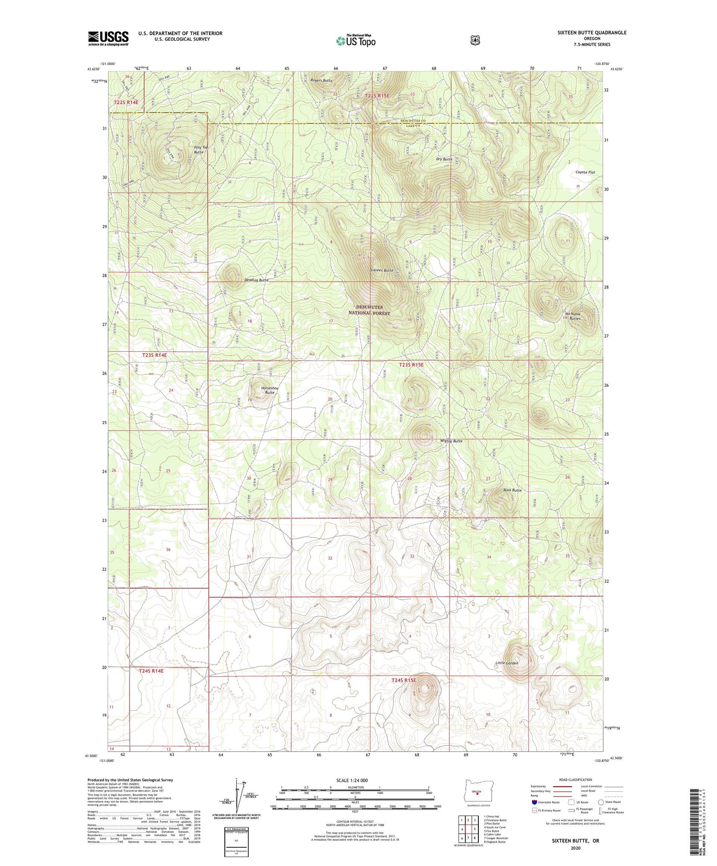
2020 topographic map quadrangle Sixteen Butte in the state of Oregon. Scale: 1:24000. Based on the newly updated USGS 7.5' US Topo map series, this map is in the following counties: Lake, Deschutes. The map contains contour data, water features, and other items you are used to seeing on USGS maps, but also has updated roads and other features. This is the next generation of topographic maps. Printed on high-quality waterproof paper with UV fade-resistant inks.
Quads adjacent to this one:
West: South Ice Cave
Northwest: China Hat
North: Firestone Butte
Northeast: Plot Butte
East: Fox Butte
Southeast: Hogback Butte
South: Cougar Mountain
Southwest: Cabin Lake
Contains the following named places: Buck Butte, Coyote Flat, Deadlog Butte, Dry Butte, Horseshoe Butte, Little Garden, Mortimer Well, No Name Buttes, North Webster Well, Poly Top Butte, Sixteen Butte, Steigleder Well, The Devils Garden, Wigtop Butte