MyTopo
Cabin Lake Oregon US Topo Map
Couldn't load pickup availability
Also explore the Cabin Lake Forest Service Topo of this same quad for updated USFS data
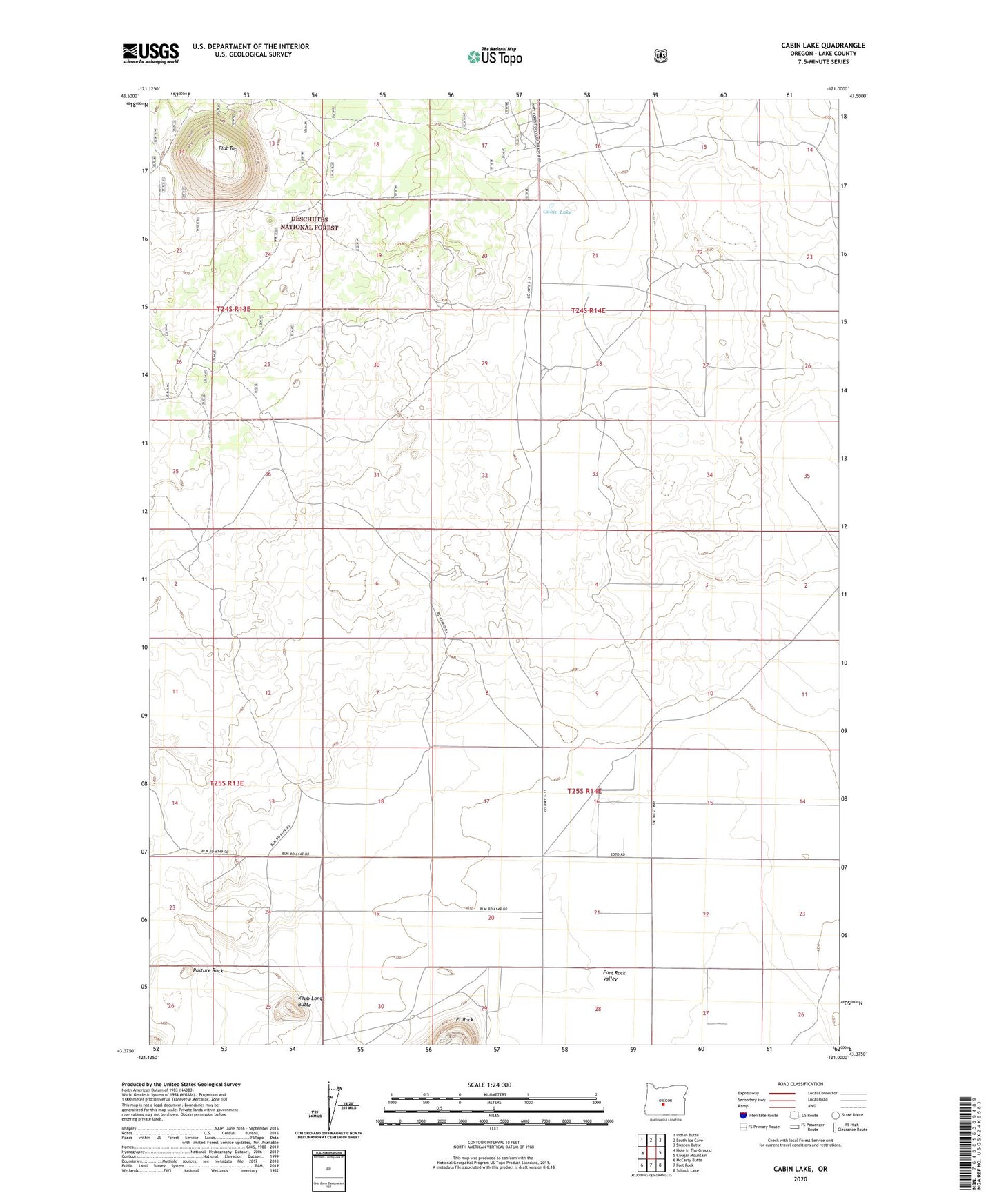
2023 topographic map quadrangle Cabin Lake in the state of Oregon. Scale: 1:24000. Based on the newly updated USGS 7.5' US Topo map series, this map is in the following counties: Lake. The map contains contour data, water features, and other items you are used to seeing on USGS maps, but also has updated roads and other features. This is the next generation of topographic maps. Printed on high-quality waterproof paper with UV fade-resistant inks.
Quads adjacent to this one:
West: Hole In The Ground
Northwest: Indian Butte
North: South Ice Cave
Northeast: Sixteen Butte
East: Cougar Mountain
Southeast: Schaub Lake
South: Fort Rock
Southwest: McCarty Butte
This map covers the same area as the classic USGS quad with code o43121d1.
Contains the following named places: Beeler Well, Button Well, Cabin Lake, Cabin Lake Ranger Station, Cabin Lake Recreation Site, Crampton Well, Flat Top, Harrison Reservoir, Hill Well, Jacobson Well, Pasture Rock, Poppy Well, Reub Long Butte, Section 19 Well, Wegert Well