MyTopo
South Ice Cave Oregon US Topo Map
Couldn't load pickup availability
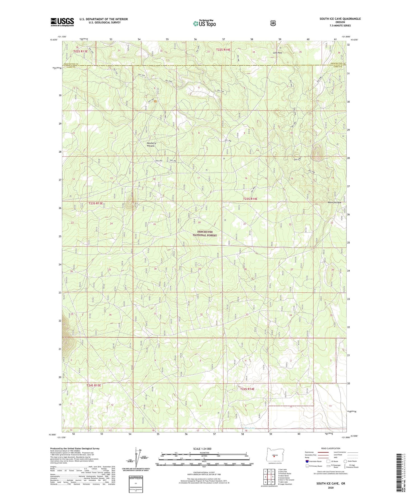
2020 topographic map quadrangle South Ice Cave in the state of Oregon. Scale: 1:24000. Based on the newly updated USGS 7.5' US Topo map series, this map is in the following counties: Lake, Deschutes. The map contains contour data, water features, and other items you are used to seeing on USGS maps, but also has updated roads and other features. This is the next generation of topographic maps. Printed on high-quality waterproof paper with UV fade-resistant inks.
Quads adjacent to this one:
West: Indian Butte
Northwest: East Lake
North: China Hat
Northeast: Firestone Butte
East: Sixteen Butte
Southeast: Cougar Mountain
South: Cabin Lake
Southwest: Hole In The Ground
Contains the following named places: B S Well, East Pine Lake Well, Issa Draw, Lava Crossing Cinder Pit, Lava Pass, Pine Lake, South Ice Cave Cinder Pit, South Ice Cave Recreation Site, South Lava Trailhead, Waterfall Rim