MyTopo
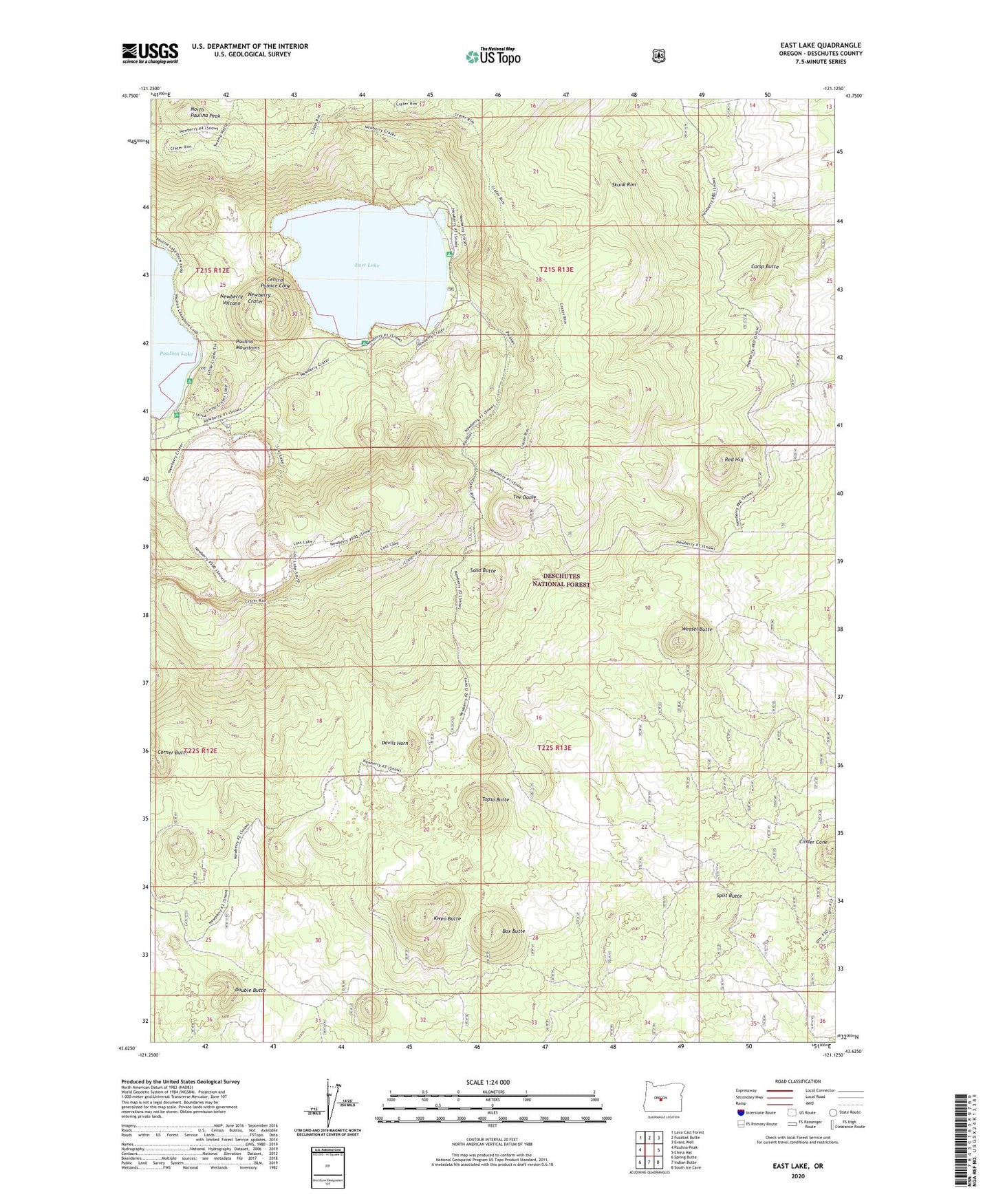
East Lake Oregon US Topo Map
Couldn't load pickup availability
Also explore the East Lake Forest Service Topo of this same quad for updated USFS data
2024 topographic map quadrangle East Lake in the state of Oregon. Scale: 1:24000. Based on the newly updated USGS 7.5' US Topo map series, this map is in the following counties: Deschutes. The map contains contour data, water features, and other items you are used to seeing on USGS maps, but also has updated roads and other features. This is the next generation of topographic maps. Printed on high-quality waterproof paper with UV fade-resistant inks.
Quads adjacent to this one:
West: Paulina Peak
Northwest: Lava Cast Forest
North: Fuzztail Butte
Northeast: Evans Well
East: China Hat
Southeast: South Ice Cave
South: Indian Butte
Southwest: Spring Butte
This map covers the same area as the classic USGS quad with code o43121f2.
Contains the following named places: Atsa Cone, Big Obsidian Flow Trailhead, Box Butte, Camp Butte, Central Pumice Cone, Cinder Cone, Cinder Hill Campground Boat Ramp, Cinder Hill Recreation Site, Devils Horn, Double Butte, East Lake, East Lake Campground Boat Ramp, East Lake Recreation Site, East Lake Resort, East Lake Resort Marina, Hot Springs Boating Site, Hot Springs Recreation Site, Kweo Butte, Little Crater Campground Boat Ramp, Little Crater Recreation Site, Newberry Crater, Newberry Volcano, North Paulina Peak, Qdai Dome, Red Hill, Sabas Butte, Sand Butte, Skunk Rim, Split Butte, The Dome, Topso Butte, Warm Springs Campground, Wasam Butte, Weasel Butte