MyTopo
Star Valley Knoll Oregon US Topo Map
Couldn't load pickup availability
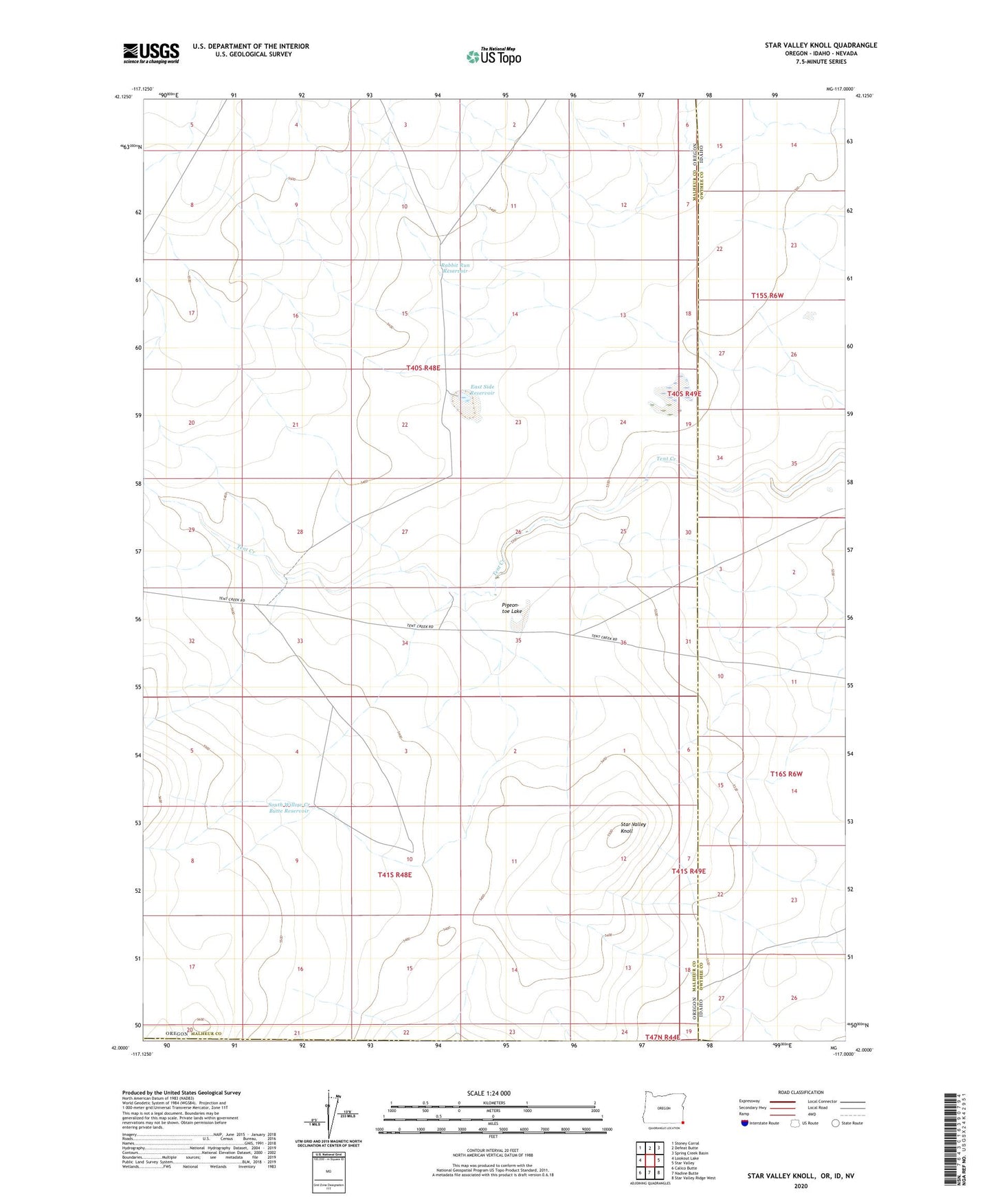
2024 topographic map quadrangle Star Valley Knoll in the state of Oregon. Scale: 1:24000. Based on the newly updated USGS 7.5' US Topo map series, this map is in the following counties: Malheur, Owyhee, Humboldt. The map contains contour data, water features, and other items you are used to seeing on USGS maps, but also has updated roads and other features. This is the next generation of topographic maps. Printed on high-quality waterproof paper with UV fade-resistant inks.
Quads adjacent to this one:
West: Lookout Lake
Northwest: Stoney Corral
North: Defeat Butte
Northeast: Spring Creek Basin
East: Star Valley
Southeast: Star Valley Ridge West
South: Nadine Butte
Southwest: Calico Butte
This map covers the same area as the classic USGS quad with code o42117a1.
Contains the following named places: East Side Reservoir, Pigeon-toe Lake, Rabbit Run Reservoir, South Willow Creek Butte Reservoir, Star Valley Knoll