MyTopo
Swaggart Buttes Oregon US Topo Map
Couldn't load pickup availability
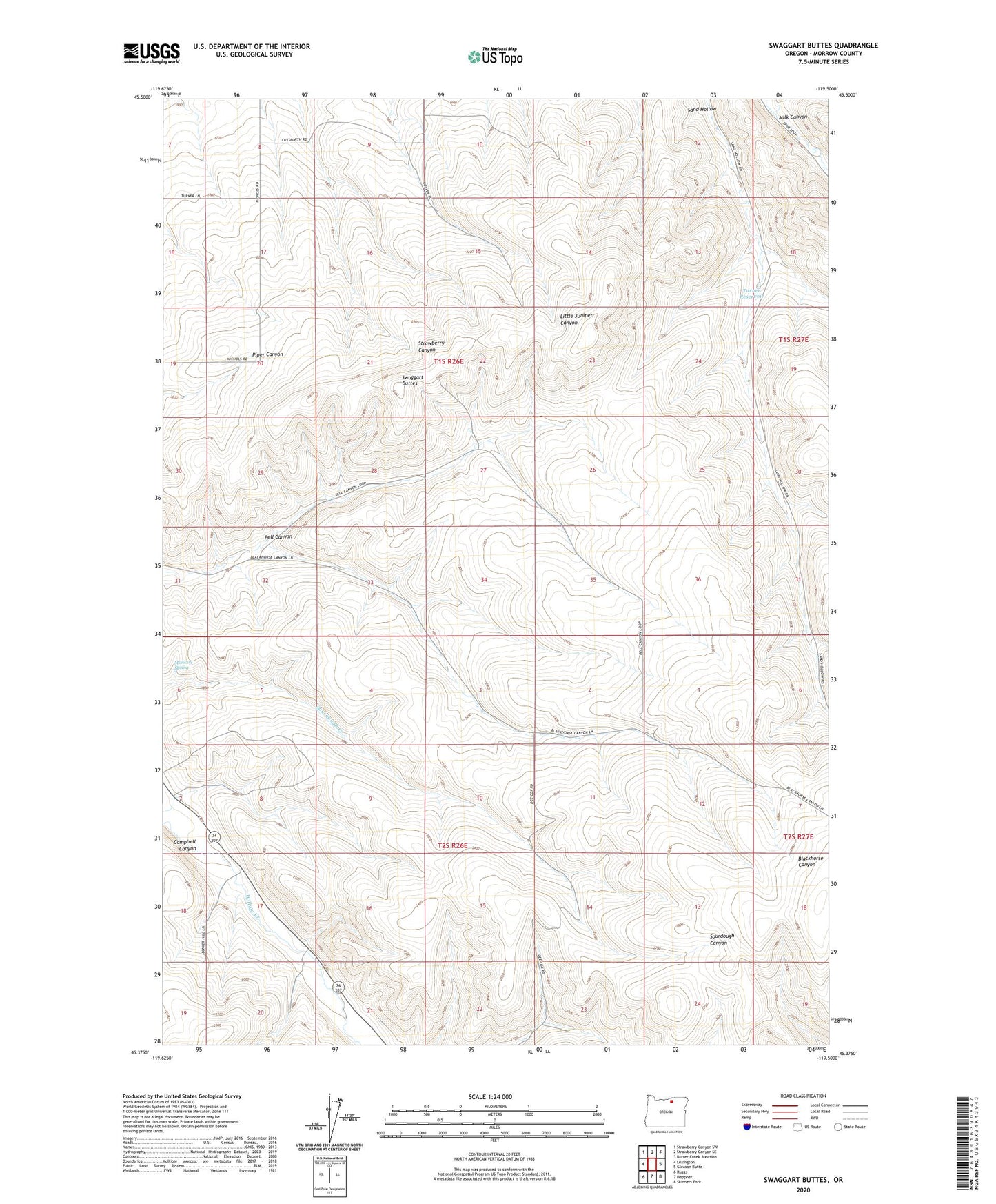
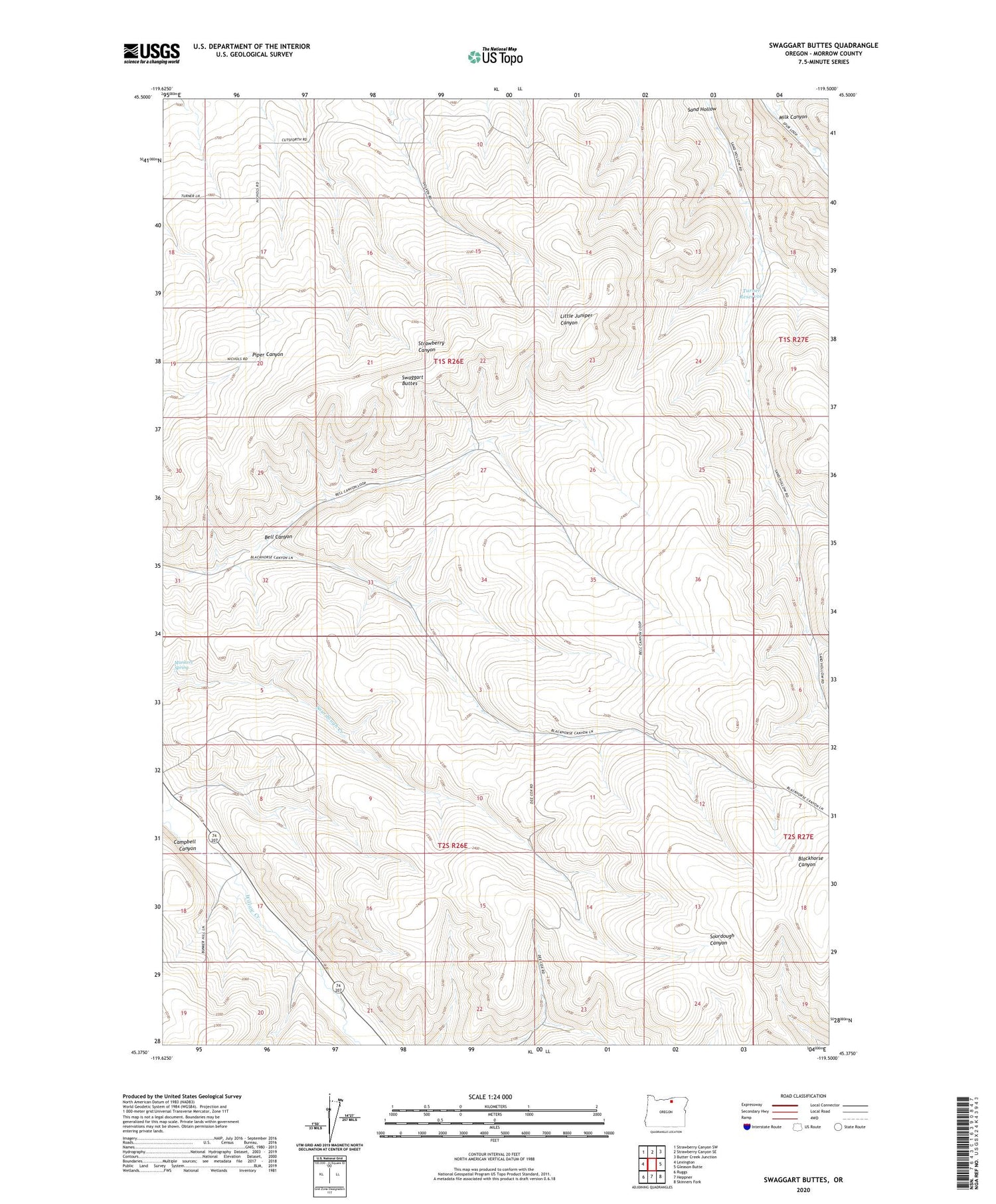
2020 topographic map quadrangle Swaggart Buttes in the state of Oregon. Scale: 1:24000. Based on the newly updated USGS 7.5' US Topo map series, this map is in the following counties: Morrow. The map contains contour data, water features, and other items you are used to seeing on USGS maps, but also has updated roads and other features. This is the next generation of topographic maps. Printed on high-quality waterproof paper with UV fade-resistant inks.
Quads adjacent to this one:
West: Lexington
Northwest: Strawberry Canyon SW
North: Strawberry Canyon SE
Northeast: Butter Creek Junction
East: Gleason Butte
Southeast: Skinners Fork
South: Heppner
Southwest: Ruggs
Contains the following named places: Bell Canyon, Heppner Power Plant, Morrow County, Munkers Spring, Swaggart Buttes, Turner Reservoir