MyTopo
Heppner Oregon US Topo Map
Couldn't load pickup availability
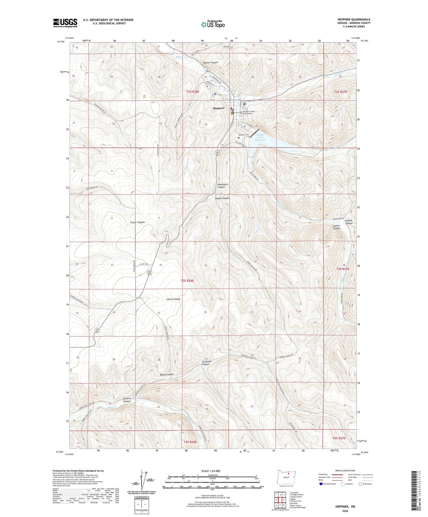
2024 topographic map quadrangle Heppner in the state of Oregon. Scale: 1:24000. Based on the newly updated USGS 7.5' US Topo map series, this map is in the following counties: Morrow. The map contains contour data, water features, and other items you are used to seeing on USGS maps, but also has updated roads and other features. This is the next generation of topographic maps. Printed on high-quality waterproof paper with UV fade-resistant inks.
Quads adjacent to this one:
West: Ruggs
Northwest: Lexington
North: Swaggart Buttes
Northeast: Gleason Butte
East: Skinners Fork
Southeast: Summerfield Ridge
South: Balm Canyon
Southwest: Hardman
This map covers the same area as the classic USGS quad with code o45119c5.
Contains the following named places: Balm Fork, Basey Canyon, City of Heppner, City of Heppner Fire Department, City Park, Department of Motor Vehicles Heppner, Donaldson Canyon, Dutton Canyon, Hager Park, Heppner, Heppner City Hall, Heppner Elementary School, Heppner Junior - Senior High School, Heppner Justice Court, Heppner Police Department, Heppner Post Office, Heppner Public Works Department, Heppner Ranger Station, Heppner Wastewater Treatment Plant, Heritage Park, Hinton Creek, Masonic Cemetery, Morrow County Agriculture Museum, Morrow County Courthouse, Morrow County Fairgrounds, Morrow County Fairgrounds Rodeo Arena, Morrow County Health Department Office, Morrow County Law Library, Morrow County Museum, Morrow County Sheriff's Office, Oregon Trail Library District Heppner Branch Library, Pioneer Memorial Hospital, Sanford Canyon, Shobe Canyon, Shobe Creek, Six Dollar Canyon, Soocup Canyon, Stalter Canyon, United States Forest Service Guard Station, Veterans Mini Park, Willow Creek Dam, Willow Creek Lake Boat Ramp, Willow Creek Reservoir