
MyTopo
Tea Table Mountain Oregon US Topo Map
Couldn't load pickup availability
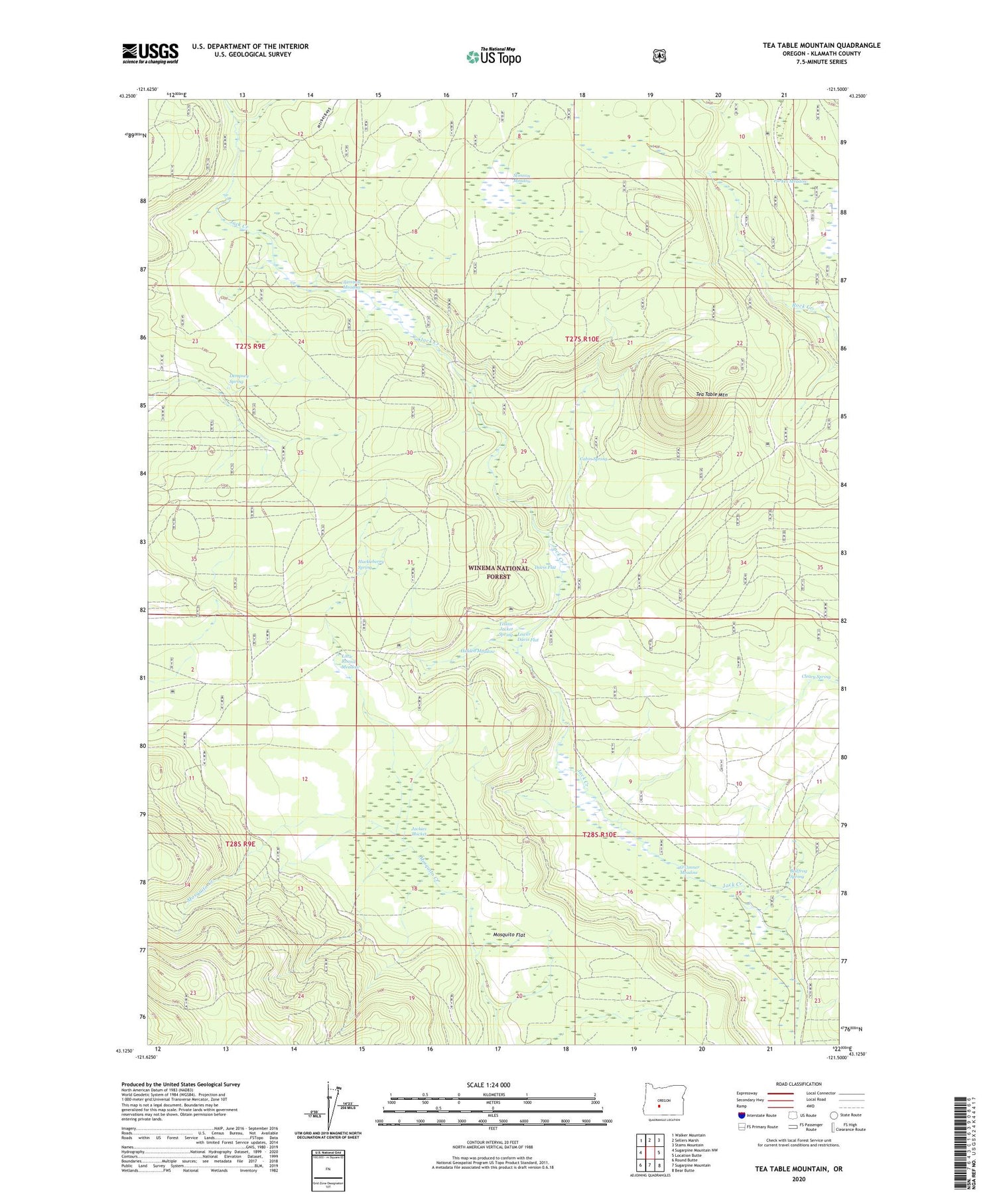
2020 topographic map quadrangle Tea Table Mountain in the state of Oregon. Scale: 1:24000. Based on the newly updated USGS 7.5' US Topo map series, this map is in the following counties: Klamath. The map contains contour data, water features, and other items you are used to seeing on USGS maps, but also has updated roads and other features. This is the next generation of topographic maps. Printed on high-quality waterproof paper with UV fade-resistant inks.
Quads adjacent to this one:
West: Sugarpine Mountain NW
Northwest: Walker Mountain
North: Sellers Marsh
Northeast: Stams Mountain
East: Location Butte
Southeast: Bear Butte
South: Sugarpine Mountain
Southwest: Round Butte
Contains the following named places: Bullfrog Spring, Cabin Spring, Cleary Spring, Davis Flat, Dempsey Spring, Hidden Meadow, Huckleberry Spring, Jackies Thicket, Jamison Meadow, Jamison Ranch, Lily Camp, Little Round Meadow, Lower Davis Flat, Mosquito Flat, O'Conner Meadow, Riders Camp, Stimson Meadow, Tea Table Mountain, The Rhubarb Patch, Yellow Jacket Spring


