MyTopo
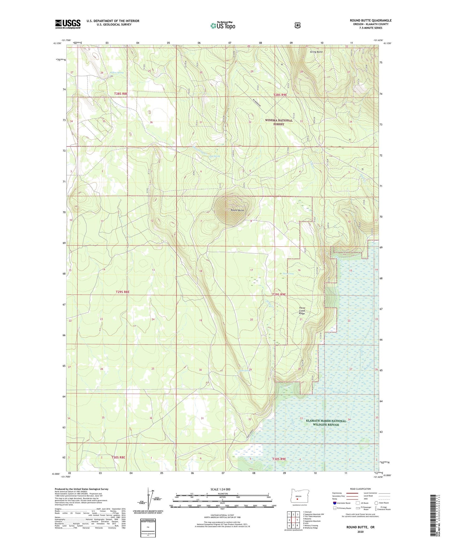
Round Butte Oregon US Topo Map
Couldn't load pickup availability
Also explore the Round Butte Forest Service Topo of this same quad for updated USFS data
2023 topographic map quadrangle Round Butte in the state of Oregon. Scale: 1:24000. Based on the newly updated USGS 7.5' US Topo map series, this map is in the following counties: Klamath. The map contains contour data, water features, and other items you are used to seeing on USGS maps, but also has updated roads and other features. This is the next generation of topographic maps. Printed on high-quality waterproof paper with UV fade-resistant inks.
Quads adjacent to this one:
West: Mazama
Northwest: Chemult
North: Sugarpine Mountain NW
Northeast: Tea Table Mountain
East: Sugarpine Mountain
Southeast: Wildhorse Ridge
South: Military Crossing
Southwest: Lenz
This map covers the same area as the classic USGS quad with code o43121a6.
Contains the following named places: Cole Creek, Lane Ranch, Log Spring, Round Butte, Shoestring Creek, String Butte, Tank Spring, Three Creek, Three Creek Guard Station, Three Creek Ridge, Willow Spring, ZIP Code: 97624