MyTopo
Location Butte Oregon US Topo Map
Couldn't load pickup availability
Also explore the Location Butte Forest Service Topo of this same quad for updated USFS data
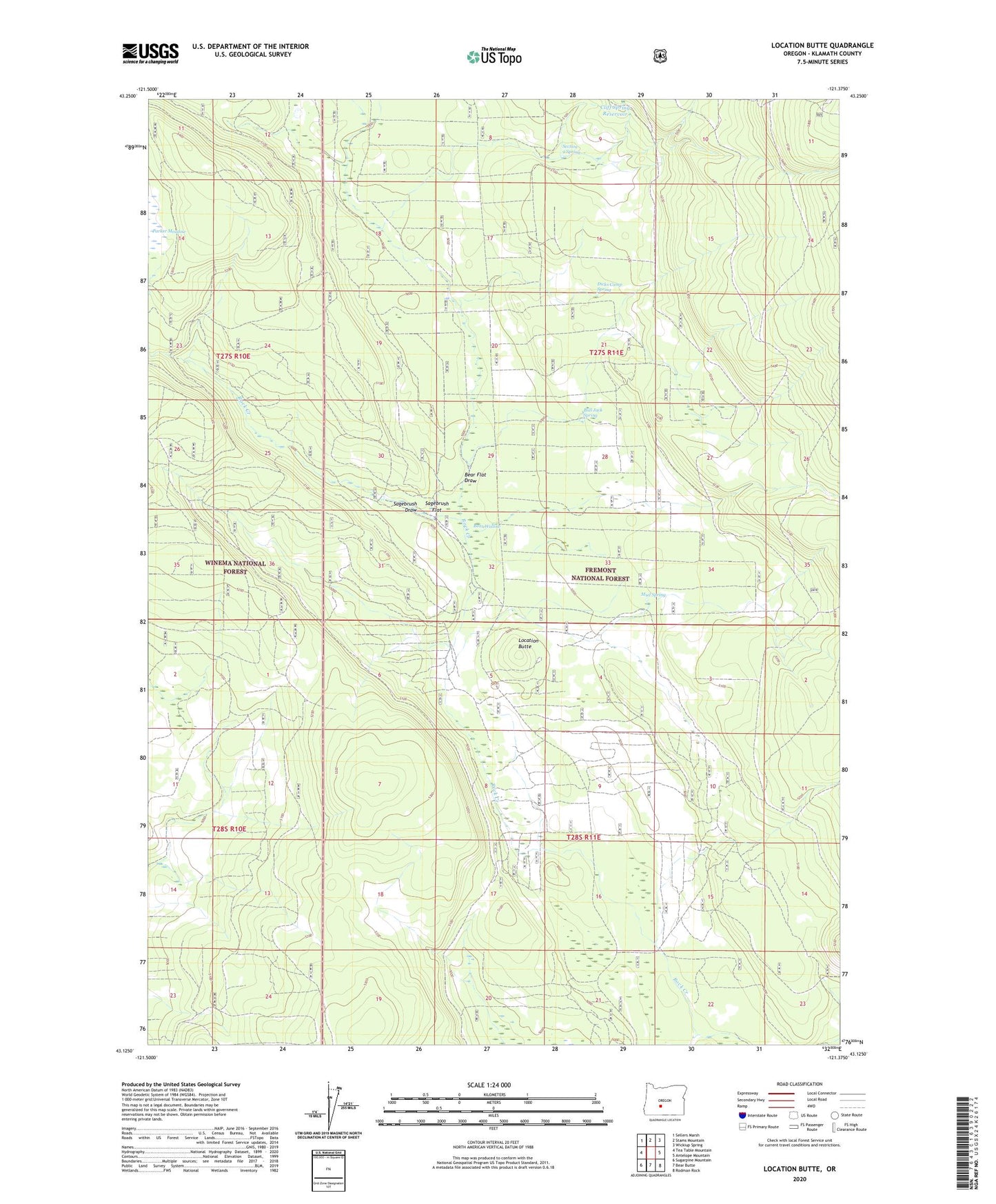
2023 topographic map quadrangle Location Butte in the state of Oregon. Scale: 1:24000. Based on the newly updated USGS 7.5' US Topo map series, this map is in the following counties: Klamath. The map contains contour data, water features, and other items you are used to seeing on USGS maps, but also has updated roads and other features. This is the next generation of topographic maps. Printed on high-quality waterproof paper with UV fade-resistant inks.
Quads adjacent to this one:
West: Tea Table Mountain
Northwest: Sellers Marsh
North: Stams Mountain
Northeast: Wickiup Spring
East: Antelope Mountain
Southeast: Rodman Rock
South: Bear Butte
Southwest: Sugarpine Mountain
This map covers the same area as the classic USGS quad with code o43121b4.
Contains the following named places: Bartley Headquarters, Bear Flat Draw, Bear Wallow, Bull Jack Spring, Cliff Spring Reservoir, Dicks Camp Spring, Location Butte, Mud Spring, Nelson Well, Parker Meadow, Sagebrush Draw, Sagebrush Flat, Section 9 Spring