
MyTopo
Tumtum Lake Oregon US Topo Map
Couldn't load pickup availability
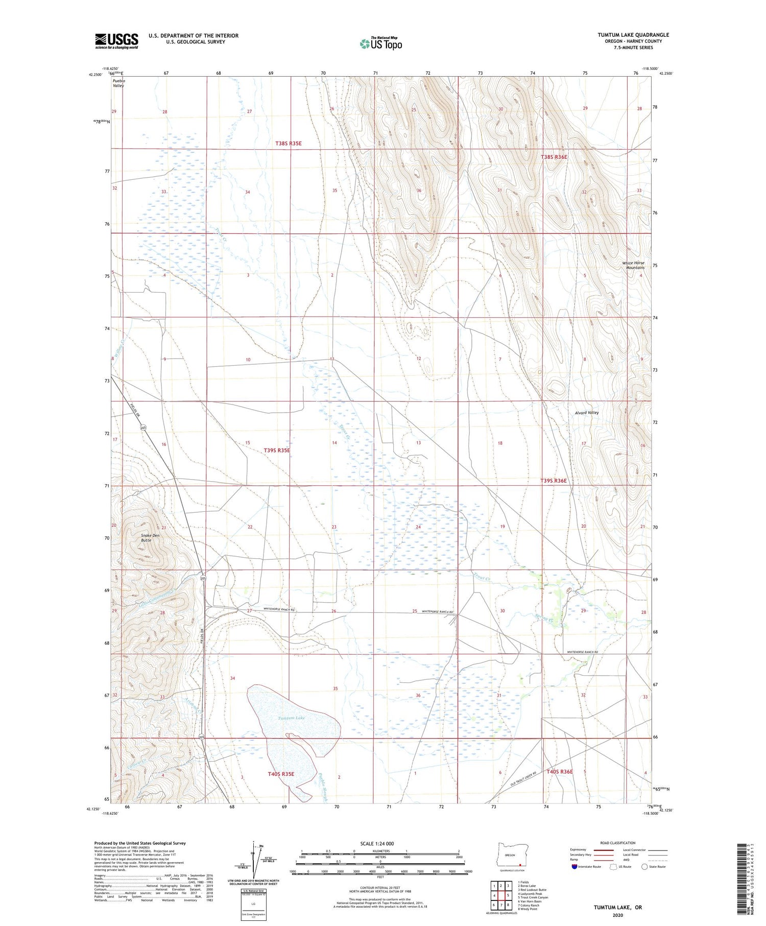
2020 topographic map quadrangle Tumtum Lake in the state of Oregon. Scale: 1:24000. Based on the newly updated USGS 7.5' US Topo map series, this map is in the following counties: Harney. The map contains contour data, water features, and other items you are used to seeing on USGS maps, but also has updated roads and other features. This is the next generation of topographic maps. Printed on high-quality waterproof paper with UV fade-resistant inks.
Quads adjacent to this one:
West: Ladycomb Peak
Northwest: Fields
North: Borax Lake
Northeast: Red Lookout Butte
East: Trout Creek Canyon
Southeast: Windy Point
South: Colony Ranch
Southwest: Van Horn Basin
Contains the following named places: Alvord Valley, Arizona Creek, Calderwood Ranch, Catlow Creek, Catlow Place, Grove Place, Little Butte Well, Little Cottonwood Creek, Lower Roux Place, McLean Well, Oroville Post Office, Outerkirk Ranch, Pueblo Slough, Sherburn Ranch, Silvey Ranch, Smith Wells, Snake Den Butte, Spring Creek, Trout Creek Ranch, Tumtum Lake, White Horse Mountains, Willow Creek


