MyTopo
Van Horn Basin Oregon US Topo Map
Couldn't load pickup availability
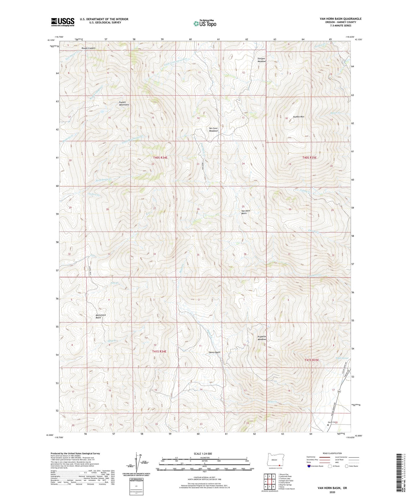
2024 topographic map quadrangle Van Horn Basin in the state of Oregon. Scale: 1:24000. Based on the newly updated USGS 7.5' US Topo map series, this map is in the following counties: Harney. The map contains contour data, water features, and other items you are used to seeing on USGS maps, but also has updated roads and other features. This is the next generation of topographic maps. Printed on high-quality waterproof paper with UV fade-resistant inks.
Quads adjacent to this one:
West: Oregon End Table
Northwest: Rincon Flat
North: Ladycomb Peak
Northeast: Tumtum Lake
East: Colony Ranch
Southeast: Wilder Creek Ranch
South: Denio
Southwest: Bog Hot Springs
This map covers the same area as the classic USGS quad with code o42118a6.
Contains the following named places: Crickett Creek, Denio Basin, Denio Cemetery, Denio Post Office, Little Stonehouse Creek, Mapes Springs, Monument Basin, O'Conner Homestead, Poor Farm, Propeller Meadows, Pueblo Mountain, Pueblo Mountains, Pueblo Mountains Wilderness Study Area, Stergen Meadows, Ten Cent Meadows, Tiller Cabin, Van Horn Basin