MyTopo
Fields Oregon US Topo Map
Couldn't load pickup availability
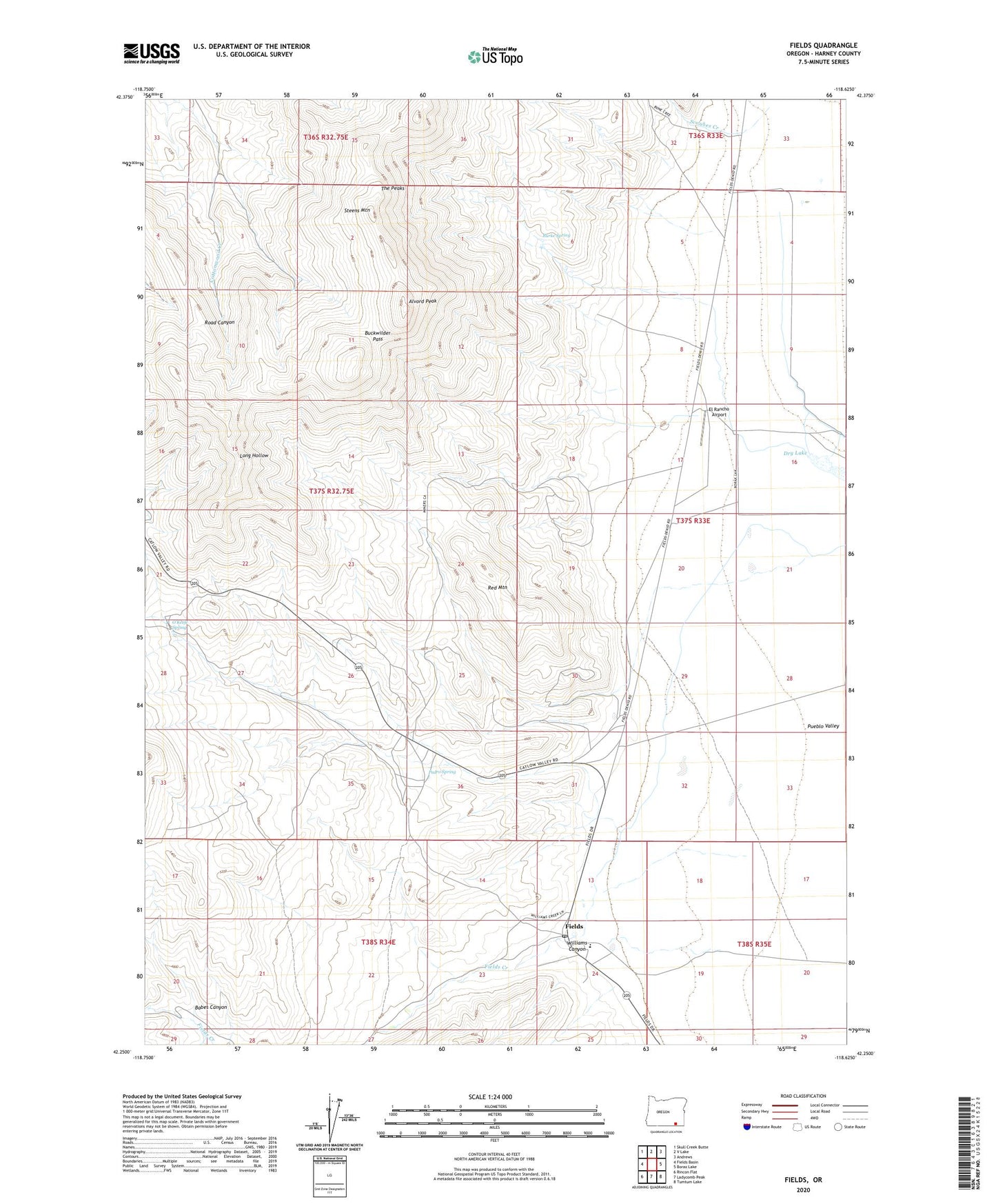
2024 topographic map quadrangle Fields in the state of Oregon. Scale: 1:24000. Based on the newly updated USGS 7.5' US Topo map series, this map is in the following counties: Harney. The map contains contour data, water features, and other items you are used to seeing on USGS maps, but also has updated roads and other features. This is the next generation of topographic maps. Printed on high-quality waterproof paper with UV fade-resistant inks.
Quads adjacent to this one:
West: Fields Basin
Northwest: Skull Creek Butte
North: V Lake
Northeast: Andrews
East: Borax Lake
Southeast: Tumtum Lake
South: Ladycomb Peak
Southwest: Rincon Flat
This map covers the same area as the classic USGS quad with code o42118c6.
Contains the following named places: Alvord Peak, Babes Canyon, Buckwilder Pass, Burke Spring, Calderwood Place, Dry Lake, El Rancho Airport, Fields, Fields Creek, Fields Elementary School, Fields Post Office, Lucky Star Mine, Mogul Mine, O'Keefe Spring, Pedro Spring, Red Mountain, Scoubes Creek, Williams Canyon