MyTopo
Valsetz Oregon US Topo Map
Couldn't load pickup availability
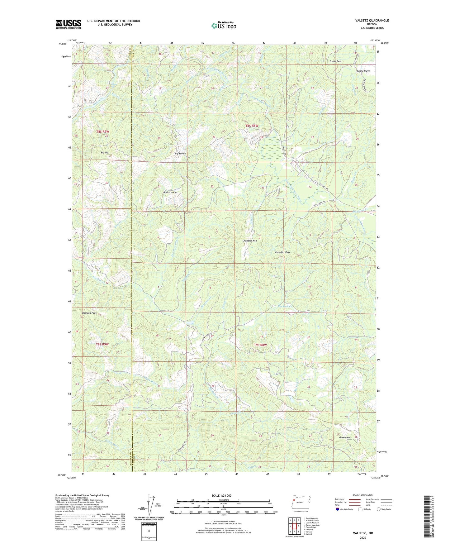
2020 topographic map quadrangle Valsetz in the state of Oregon. Scale: 1:24000. Based on the newly updated USGS 7.5' US Topo map series, this map is in the following counties: Polk, Lincoln. The map contains contour data, water features, and other items you are used to seeing on USGS maps, but also has updated roads and other features. This is the next generation of topographic maps. Printed on high-quality waterproof paper with UV fade-resistant inks.
Quads adjacent to this one:
West: Euchre Mountain
Northwest: Stott Mountain
North: Warnicke Creek
Northeast: Laurel Mountain
East: Fanno Ridge
Southeast: Summit
South: Nortons
Southwest: Eddyville
Contains the following named places: Beaver Creek, Bend Creek, Big Saddle, Big Tip, Blind Creek, Buckskin Flat, Camp Russell, Chandler Mountain, Chandler Pass, Chandler Post Office, Deer Creek, Diamond Peak, Drift Creek, Falls Creek, Fanno Creek, Fanno Peak, Found Creek, Fourth of July Creek, Green Mountain, Handy Creek, Lucas Creek, McSheery Creek, Pigeon Creek, Potter Creek, Rocca Post Office, Rogers Creek, Short Creek, Siletz Reservation, Slate Creek, Valsetz, Valsetz Falls, Valsetz Lake, Valsetz Lake Dam, Valsetz Post Office, Western Camp, Whiskey Creek, Young Creek