MyTopo
Summit Oregon US Topo Map
Couldn't load pickup availability
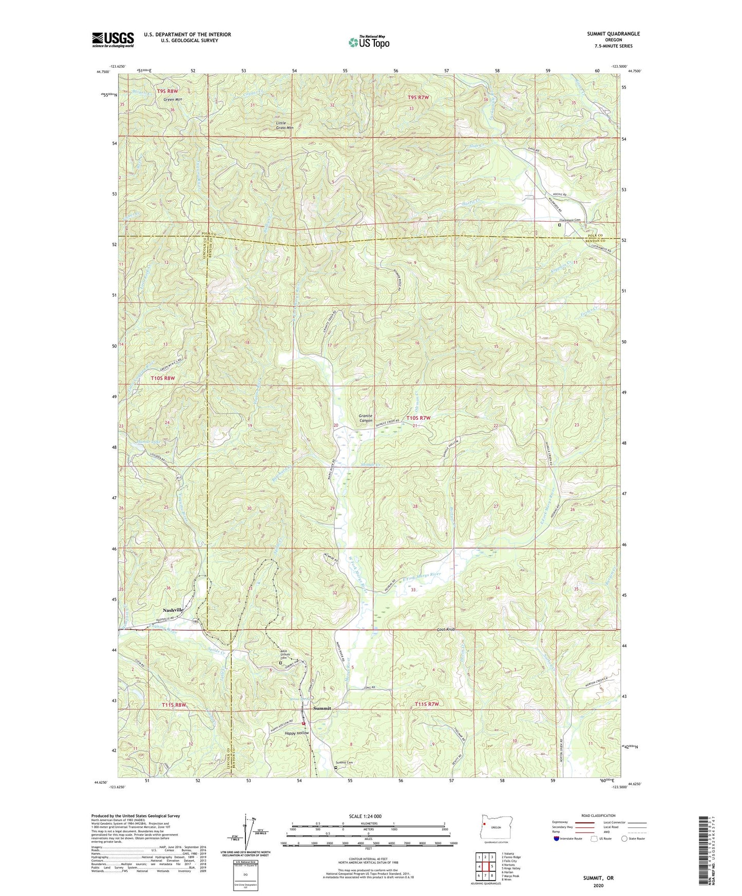
2023 topographic map quadrangle Summit in the state of Oregon. Scale: 1:24000. Based on the newly updated USGS 7.5' US Topo map series, this map is in the following counties: Benton, Polk, Lincoln. The map contains contour data, water features, and other items you are used to seeing on USGS maps, but also has updated roads and other features. This is the next generation of topographic maps. Printed on high-quality waterproof paper with UV fade-resistant inks.
Quads adjacent to this one:
West: Nortons
Northwest: Valsetz
North: Fanno Ridge
Northeast: Falls City
East: Kings Valley
Southeast: Wren
South: Marys Peak
Southwest: Harlan
This map covers the same area as the classic USGS quad with code o44123f5.
Contains the following named places: Arell, Bailey Creek, Blodgett - Summit Rural Fire Protection District Station 2, Bottger Creek, Burchard Creek, Claremont Cemetery, East Fork Marys River, Fisherman Camp, Goat Knob, Granite Canyon, Hamar Lake, Happy Hollow, Happy Hollow Creek, Harris Creek, Humphrey Creek, Kopplein Creek, Little Grass Mountain, Little Yaquina River, Mays Strouts Cemetery, Nashville, Nashville Post Office, Oleman Creek, Seekay, Shingle Creek, Slide Creek, Spilde Creek, Strout Spring, Summit, Summit Cemetery, Summit Census Designated Place, Summit Post Office, West Fork Marys River, Wildwood School