MyTopo
Waterloo Oregon US Topo Map
Couldn't load pickup availability
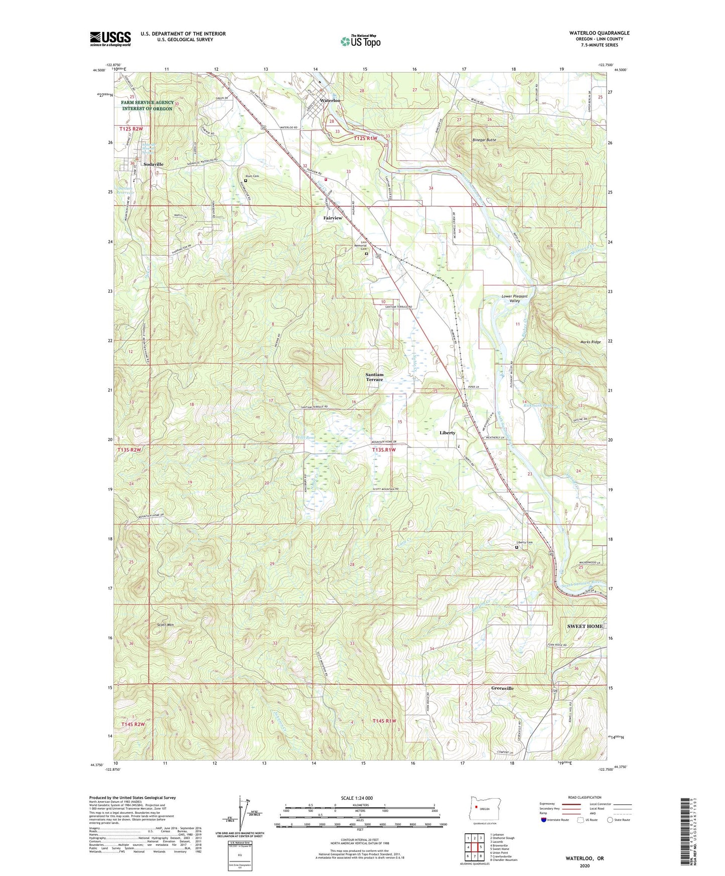
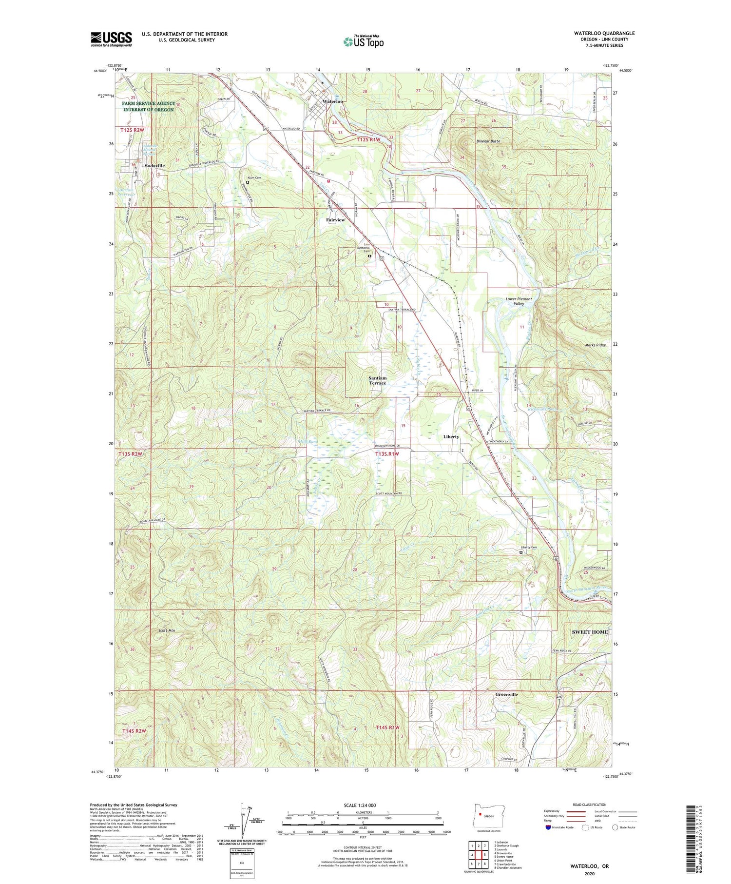
2020 topographic map quadrangle Waterloo in the state of Oregon. Scale: 1:24000. Based on the newly updated USGS 7.5' US Topo map series, this map is in the following counties: Linn. The map contains contour data, water features, and other items you are used to seeing on USGS maps, but also has updated roads and other features. This is the next generation of topographic maps. Printed on high-quality waterproof paper with UV fade-resistant inks.
Quads adjacent to this one:
West: Brownsville
Northwest: Lebanon
North: Onehorse Slough
Northeast: Lacomb
East: Sweet Home
Southeast: Chandler Mountain
South: Crawfordsville
Southwest: Union Point
Contains the following named places: Antique Apple Orchard, Bauman Lumber Company, Benjo Milling Company, Berlin Union Church, Beulahland School, Bigbee Creek, Binegar Butte, Boise Cascade Plywood, City of Sodaville, Durlam Reservoir, Fairview, Fairview School, G and G Lumber Company, Gabriel Creek, Gas Heat, Grass Ridge Post Office, Greenville, Hills Pond, J H Baxter Company, Kell Lumber Company, Kenshaws-Bauman Sales Incorporated, Klum Cemetery, Lebanon Fire District Station 33, Liberty, Liberty Cemetery, Liberty School, Linn Memorial Cemetery, Little Creek, Lower Pleasant Valley, M B Christianson, McDowell Creek, Mid Plywood Incorporated, Mountain Home, Narrows, Noble Creek, Nye, Rickmans Pond, Roaring Creek, Sand Ridge Charter School, Santiam Post Office, Santiam Terrace, Scott Mountain, Soda Springs Post Office, Sodaville, Sodaville City Hall, Sodaville Mineral Springs, Sodaville Post Office, Sodaville Springs Park, Timber Owners Incorporated, Town of Waterloo, Waterloo, Waterloo City Hall, Waterloo County Park, Waterloo County Park Claude Cox Addition Lower Boat Ramp, Waterloo County Park Upper Boat Ramp, Waterloo Post Office, Waterville School