MyTopo
Lacomb Oregon US Topo Map
Couldn't load pickup availability
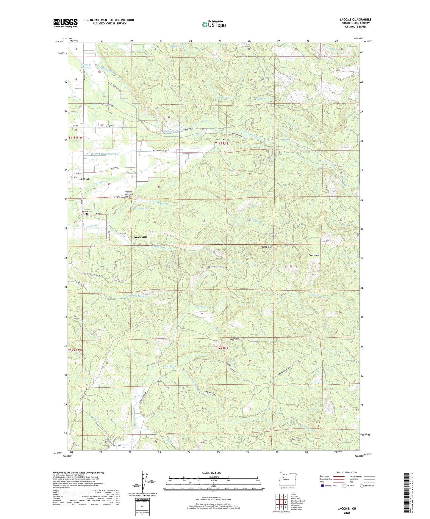
2024 topographic map quadrangle Lacomb in the state of Oregon. Scale: 1:24000. Based on the newly updated USGS 7.5' US Topo map series, this map is in the following counties: Linn. The map contains contour data, water features, and other items you are used to seeing on USGS maps, but also has updated roads and other features. This is the next generation of topographic maps. Printed on high-quality waterproof paper with UV fade-resistant inks.
Quads adjacent to this one:
West: Onehorse Slough
Northwest: Scio
North: Jordan
Northeast: Snow Peak
East: Keel Mountain
Southeast: Green Peter
South: Sweet Home
Southwest: Waterloo
This map covers the same area as the classic USGS quad with code o44122e6.
Contains the following named places: Billy Creek, Church Creek, Crabtree Guard Station, Deer Creek, East Berlin School, Fords Mill, Green Mountain, Green Mountain Creek, Green Mountain School, Hammond Camp, Hodges Spring, Hoerauf Reservoir, Hunter Creek, Jack Creek, Lacomb, Lacomb Cemetery, Lacomb Census Designated Place, Lacomb Irrigation Canal, Lacomb Post Office, Lacomb School, Lebanon Fire District Station 32, Milky Fork, Round Mountain, Scott Creek, South Fork Beaver Creek, South Fork Scott Creek, Weddle Covered Bridge