MyTopo
Union Point Oregon US Topo Map
Couldn't load pickup availability
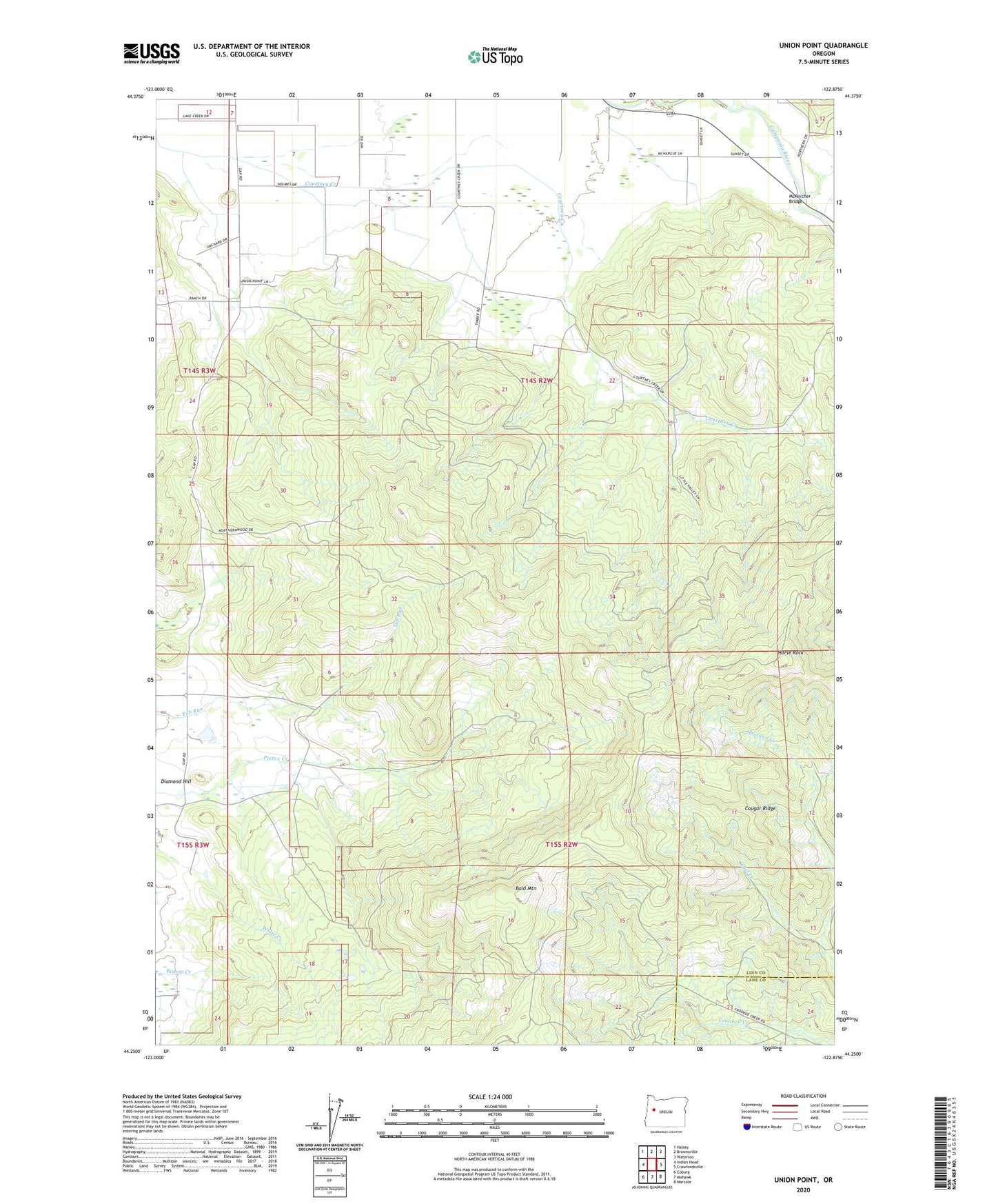
2024 topographic map quadrangle Union Point in the state of Oregon. Scale: 1:24000. Based on the newly updated USGS 7.5' US Topo map series, this map is in the following counties: Linn, Lane. The map contains contour data, water features, and other items you are used to seeing on USGS maps, but also has updated roads and other features. This is the next generation of topographic maps. Printed on high-quality waterproof paper with UV fade-resistant inks.
Quads adjacent to this one:
West: Indian Head
Northwest: Halsey
North: Brownsville
Northeast: Waterloo
East: Crawfordsville
Southeast: Marcola
South: Mohawk
Southwest: Coburg
This map covers the same area as the classic USGS quad with code o44122c8.
Contains the following named places: Bald Mountain, Brownsville Division, Cougar Ridge, Courtney Creek School, Cubehole Airport, Diamond Hill, Diamond Hill Post Office, Horse Rock, McKercher Bridge, McKercher County Park, Owl Creek, Union Point, Union Point Post Office