
MyTopo
Winston Oregon US Topo Map
Couldn't load pickup availability
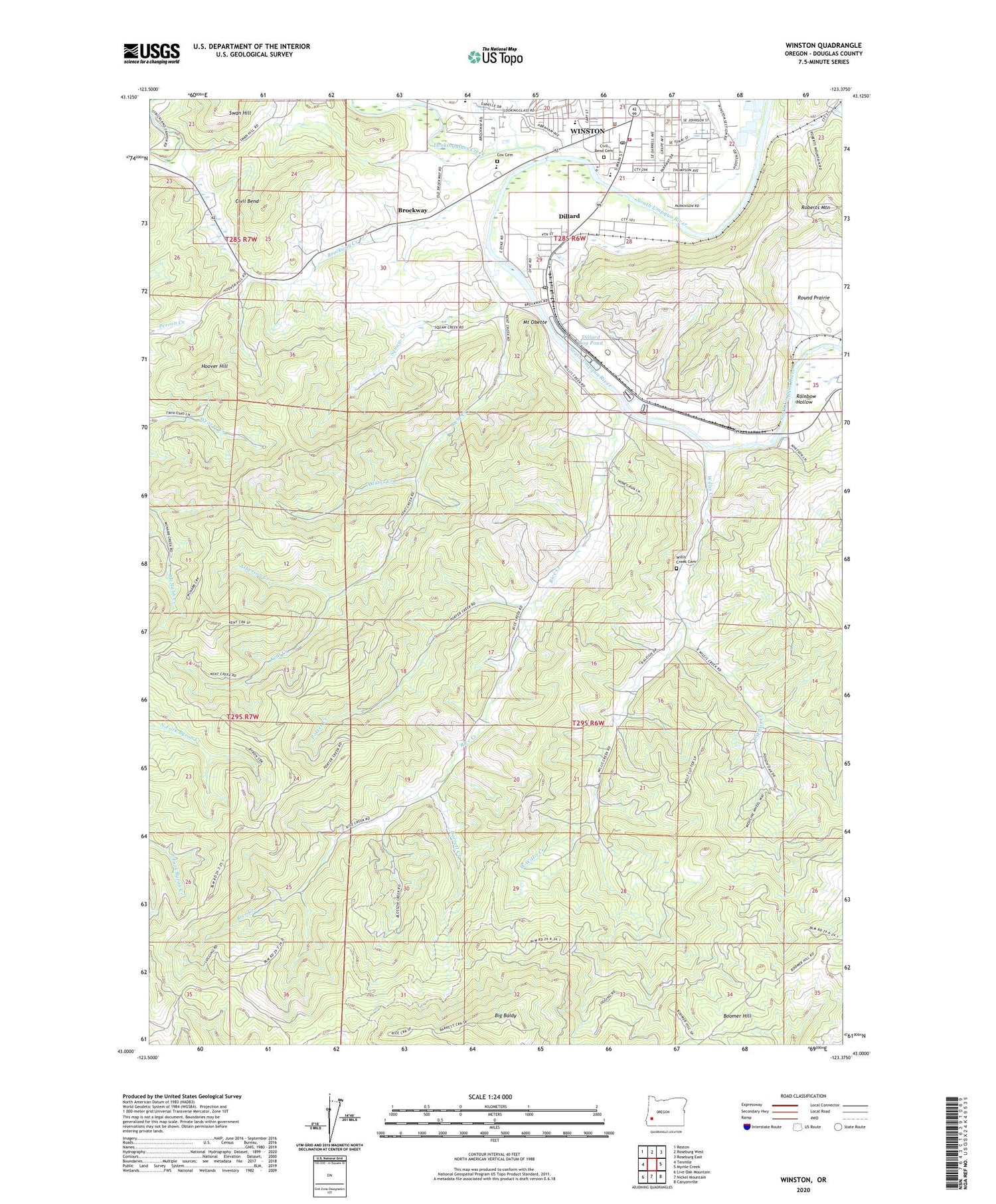
2020 topographic map quadrangle Winston in the state of Oregon. Scale: 1:24000. Based on the newly updated USGS 7.5' US Topo map series, this map is in the following counties: Douglas. The map contains contour data, water features, and other items you are used to seeing on USGS maps, but also has updated roads and other features. This is the next generation of topographic maps. Printed on high-quality waterproof paper with UV fade-resistant inks.
Quads adjacent to this one:
West: Tenmile
Northwest: Reston
North: Roseburg West
Northeast: Roseburg East
East: Myrtle Creek
Southeast: Canyonville
South: Nickel Mountain
Southwest: Live Oak Mountain
Contains the following named places: Adams Creek, Alberson Creek, Alsea Log Pond, Barrett Creek, Big Baldy, Brockway, Brockway Creek, Brockway Elementary School, Brockway Post Office, City of Winston, Civil Bend, Civil Bend Cemetery, Civil Bend Post Office, Community Center Winston Branch Library, Cox Cemetery, Dillard, Dillard Census Designated Place, Dillard Log Pond, Dillard Post Office, Douglas High School, East Willis Creek, Hoover Hill, Kent Creek, Kent Station, KGRV-AM, Lookingglass Creek, Martha Rice Bridge, McGovern Elementary School, Mount Obette, Ornoname 11 Dam, Pacific Plywood Corporation Log Pond, Pacific Plywood Dam, Porter Creek, Rainbow Hollow, Rice Creek, Roseburg Forest Products Biomass Production, Squaw Creek, West Willis Creek, Willis Creek, Willis Creek Cemetery, Winston, Winston - Dillard Water District Water Treatment Plant, Winston City Hall, Winston Dillard County Park, Winston Dillard Rural Fire Protection District, Winston Middle School, Winston Municipal Court, Winston Police Department, Winston Post Office, Winston Public Works, ZIP Code: 97496


