MyTopo
Airville Pennsylvania US Topo Map
Couldn't load pickup availability
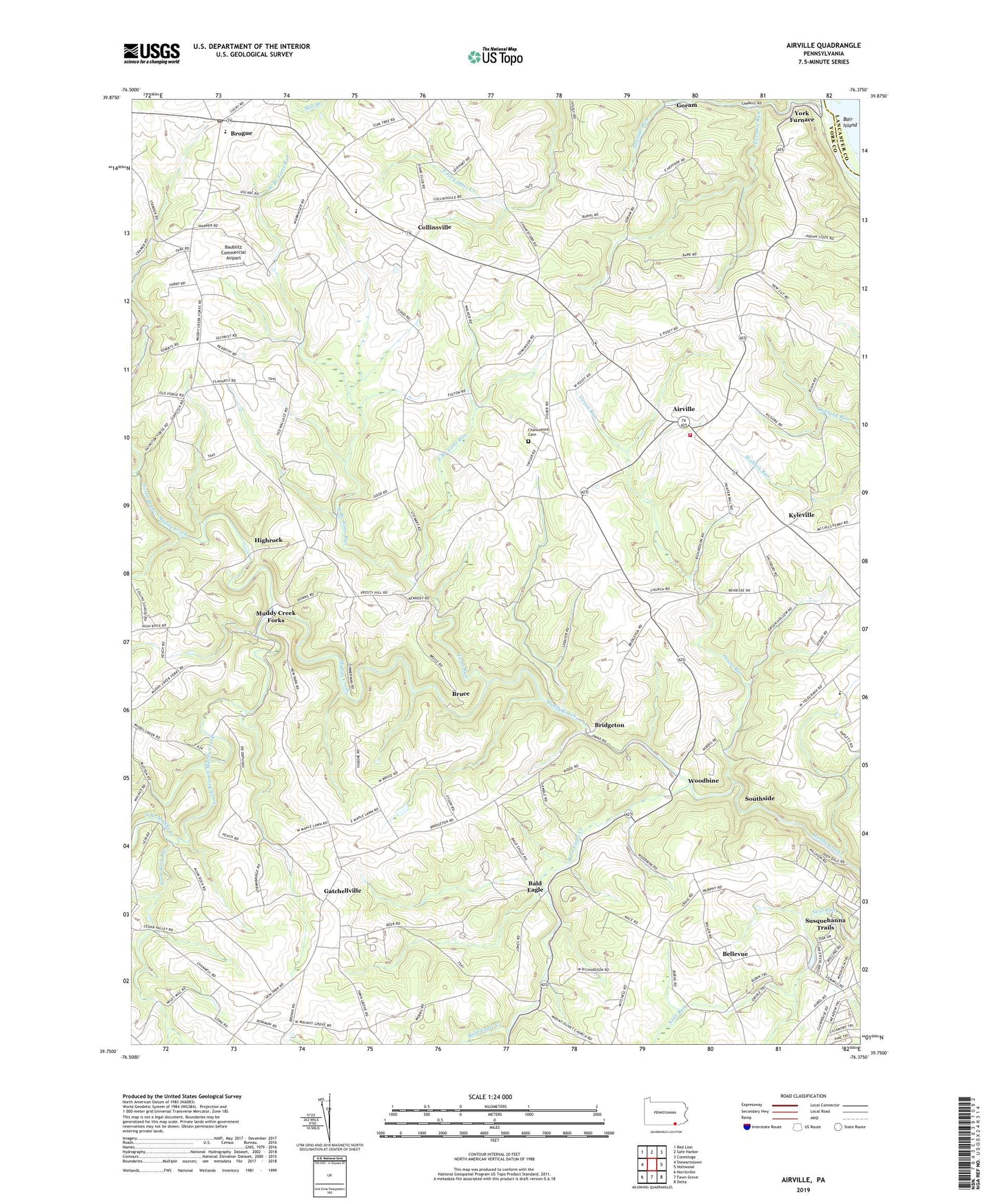
2023 topographic map quadrangle Airville in the state of Pennsylvania. Scale: 1:24000. Based on the newly updated USGS 7.5' US Topo map series, this map is in the following counties: York, Lancaster. The map contains contour data, water features, and other items you are used to seeing on USGS maps, but also has updated roads and other features. This is the next generation of topographic maps. Printed on high-quality waterproof paper with UV fade-resistant inks.
Quads adjacent to this one:
West: Stewartstown
Northwest: Red Lion
North: Safe Harbor
Northeast: Conestoga
East: Holtwood
Southeast: Delta
South: Fawn Grove
Southwest: Norrisville
This map covers the same area as the classic USGS quad with code o39076g4.
Contains the following named places: Airville, Airville Volunteer Fire Company, Alta Vista Farm, Alum Rock Run, Bair Island, Bald Eagle, Bald Eagle Creek, Baublitz Commercial Airport, Belleview School, Bellevue, Bridgeton, Brogue, Brogue Ambulance 39, Brogue Post Office, Bruce, Chanceford Cemetery, Chanceford Church, Clarkford Farms, Collins School, Collinsville, Collinsville Community Library, Daneker Seven Springs Farm, Downs Farm, East Branch Toms Run, Eichelberger Farms, Furnace Run, Gatchellville, Glatview Farms, Goram, Guinston Church, Hickorymey Farms, Hidden Bluff Farm, Highrock, Hollenthal Farm, Indian Steps Museum, Jordan Century Farms, Keeney Farms, Kyleville, Maple Springs Farm, McKendree Church, Mount Pleasant School, Muddy Creek Forks, Nick of Time Farm, North Branch Muddy Creek, Orson Run, Pleasant Grove, Prospect Church, Sawmill Run, South Branch Muddy Creek, Southside, State Game Lands Number 83, Toms Run, Township of Fawn, Township of Lower Chanceford, Twin Good Farms, Urey Islands, West Branch Toms Run, Woodbine, Woodbine Farms, York Furnace, ZIP Codes: 17302, 17309, 17352