MyTopo
Blakeslee Pennsylvania US Topo Map
Couldn't load pickup availability
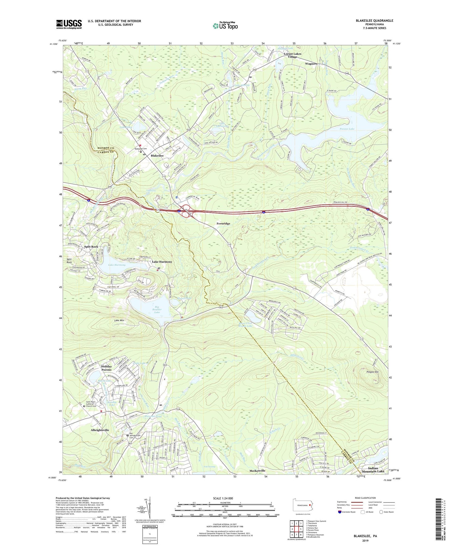
2023 topographic map quadrangle Blakeslee in the state of Pennsylvania. Scale: 1:24000. Based on the newly updated USGS 7.5' US Topo map series, this map is in the following counties: Monroe, Carbon. The map contains contour data, water features, and other items you are used to seeing on USGS maps, but also has updated roads and other features. This is the next generation of topographic maps. Printed on high-quality waterproof paper with UV fade-resistant inks.
Quads adjacent to this one:
West: Hickory Run
Northwest: Pleasant View Summit
North: Thornhurst
Northeast: Tobyhanna
East: Pocono Pines
Southeast: Brodheadsville
South: Pohopoco Mountain
Southwest: Christmans
This map covers the same area as the classic USGS quad with code o41075a5.
Contains the following named places: Albrightsville, Albrightsville Census Designated Place, Albrightsville Post Office, Albrightsville Volunteer Fire Company District 16, Association Dam, Big Boulder Dam, Big Boulder Lake, Big Boulder Ski Resort, Blakeslee, Blakeslee Cemetery, Blakeslee Estates, Blakeslee Post Office, Blakeslee School, Briar Crest Woods, Briar Crest Woods Dam, Briar Crest Woods Lake, Camelot Forest, Carpsrocus Creek, Davey Run, Deep Run, Delaware-Lehigh State Experimental Forest, Dilldown Creek, Fernridge, Forest Glen, Holiday Lake, Holiday Pocono, Holiday Pocono Census Designated Place, Indian Mountain Lake, Indian Mountain Lake Census Designated Place, Indian Mountain Lake Dam, Keipers Run, Kidder Township Police Department, Lake Guenevere, Lake Harmony, Lake Harmony Post Office, Lake Harmony Rescue Squad and Ambulance District 17, Lake Harmony Volunteer Fire Company Station 17, Lake Mountain, Lake Onocup, Lake Sinca, Laurel Run, Little Lake, Long Pond, Meckesville School, Old Albrightsville Cemetery, Pennsylvania State Police Troop N Fern Ridge Station, Pilgrim Church, Pilgrim Lake, Pimple Hill, Pine Grove School, Placid Lake, Placid Lake Dam, Pocono International Raceway, Pocono Lake, Pocono Lake Dam, Pocono Lake Post Office, Pocono Lake Preserve, Pocono Raceway Airport, Pohopoco Tower, Preserve, Red Run, Round Pond, Saint Paul's Lutheran Church Cemetery, Schoch Creek, Shingle Mill Run, Sinca Dam, Sincavage Lumber Company Dam, Spilt Rock, Split Rock, Split Rock Ski Area, State Game Lands Number 129, Stony Run, Swamp Run, Tobyhanna Falls, Tobyhanna Township Volunteer Fire Company Station 41 - Blakeslee, Towamensing Trails, Township of Tobyhanna, Tunkhannock Creek, Twomile Run, Upper Tunkhannock Creek, Wagner Run, Wagners, Wagners Forest Park, Wernetts Pond, Wolf Run, Wolfs Spring Run, Yost Swamp, ZIP Codes: 18210, 18610