MyTopo
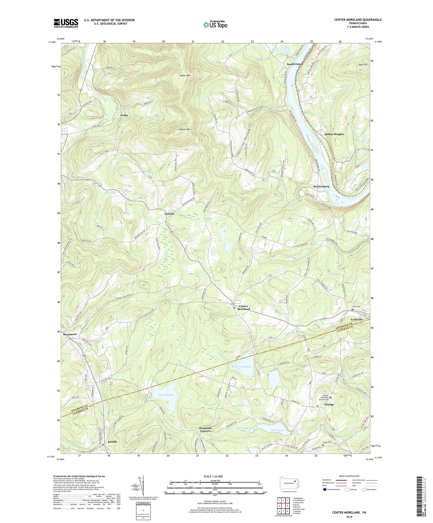
Center Moreland Pennsylvania US Topo Map
Couldn't load pickup availability
2019 topographic map quadrangle Center Moreland in the state of Pennsylvania. Scale: 1:24000. Based on the newly updated USGS 7.5' US Topo map series, this map is in the following counties: Wyoming, Luzerne. The map contains contour data, water features, and other items you are used to seeing on USGS maps, but also has updated roads and other features. This is the next generation of topographic maps. Printed on high-quality waterproof paper with UV fade-resistant inks.
Quads adjacent to this one:
West: Noxen
Northwest: Meshoppen
North: Tunkhannock
Northeast: Factoryville
East: Ransom
Southeast: Pittston
South: Kingston
Southwest: Harveys Lake
Contains the following named places: Beaumont, Center Moreland, Cummings Pond, Demunds Corners, Eaton Cemetery, Finchs Corners, Fitch Cemetery, Fitch School, Forest Grove School, Franklin Northmoreland Township Ambulance Station 535, Franklin Township Volunteer Fire Company Station 135, Hirsh Dam, Hoban Heights, Hunter School, Jenks, Keelersburg, Kunkle, Kunkle Fire Company Station 122, Lake Catalpa, Lake Catalpa Dam, Lake Louise, Lake Louise Dam, Lake Manjo, Lake Manjo Dam, Lockville, Marsh Creek, Martin Creek, Michigan School, Mill City, Miller Mountain, Moneypenny Creek, Northmoreland Township Volunteer Fire Company, Orange, Orange Methodist Church Cemetery, Perrins Marsh, Perrins Marsh Dam, Post Hill, Shaver Mountain, South Eaton, Sugar Run, Thurston, Thurston Church, Thurston Hollow, Township of Franklin, Township of Northmoreland, Twin Oaks Golf Course, Vernon, WARM-AM (Scranton), Whites Ferry