MyTopo
Noxen Pennsylvania US Topo Map
Couldn't load pickup availability
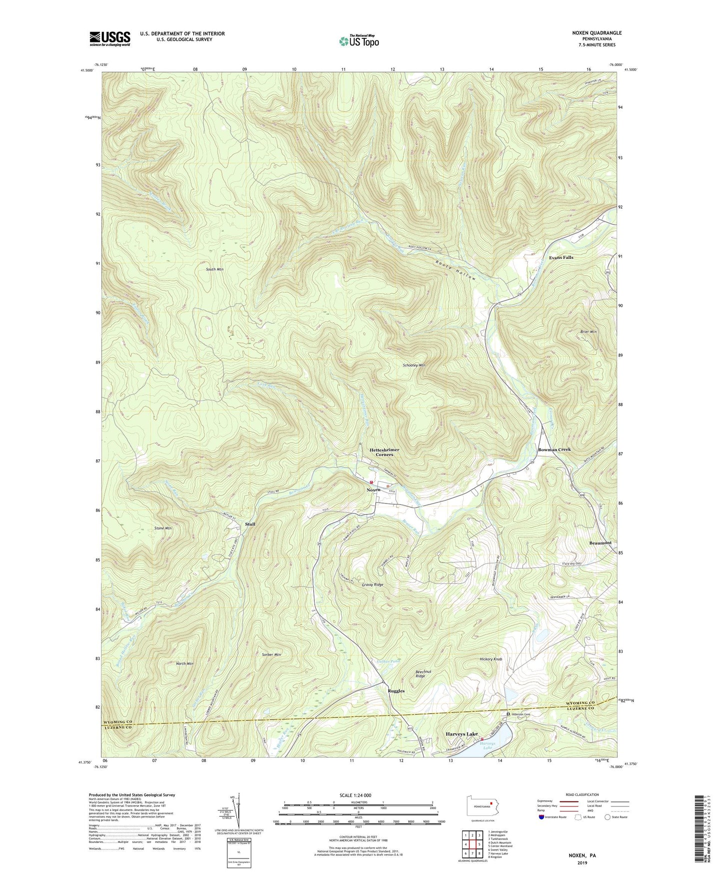
2023 topographic map quadrangle Noxen in the state of Pennsylvania. Scale: 1:24000. Based on the newly updated USGS 7.5' US Topo map series, this map is in the following counties: Wyoming, Luzerne. The map contains contour data, water features, and other items you are used to seeing on USGS maps, but also has updated roads and other features. This is the next generation of topographic maps. Printed on high-quality waterproof paper with UV fade-resistant inks.
Quads adjacent to this one:
West: Dutch Mountain
Northwest: Jenningsville
North: Meshoppen
Northeast: Tunkhannock
East: Center Moreland
Southeast: Kingston
South: Harveys Lake
Southwest: Sweet Valley
This map covers the same area as the classic USGS quad with code o41076d1.
Contains the following named places: Alderson Cemetery, Baker Run, Beaver Run, Beechnut Ridge, Bowman Creek, Brier Mountain, Broad Hollow Run, Evans Falls, Galkas Pond, Grassy Ridge, Harveys Lake, Harveys Lake Fire Department Station 138, Hettesheimer Corners, Hettesheimer Run, Hickory Knob, Leonard Creek, Newton Run, Noxen, Noxen Census Designated Place, Noxen Community Ambulance, Noxen Volunteer Fire Company, Roaring Run, Roote Hollow, Ruggles, Schooley Mountain, Sorber Mountain, Sorber Run, South Branch Roaring Run, South Mountain, South Run, Stone Mountain, Stone Run, Stull, Township of Monroe, Township of Noxen, Windfall Run, York Run, ZIP Code: 18636