MyTopo
Meshoppen Pennsylvania US Topo Map
Couldn't load pickup availability
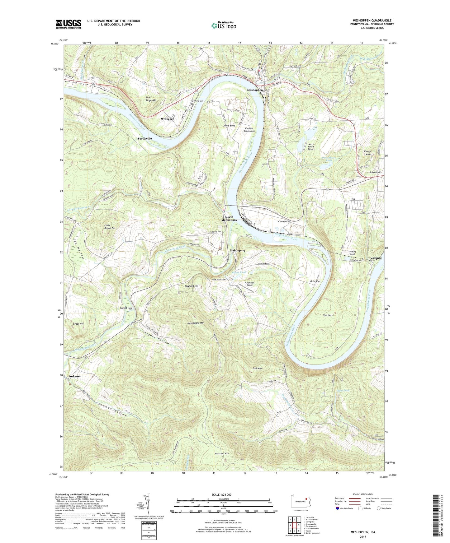
2023 topographic map quadrangle Meshoppen in the state of Pennsylvania. Scale: 1:24000. Based on the newly updated USGS 7.5' US Topo map series, this map is in the following counties: Wyoming. The map contains contour data, water features, and other items you are used to seeing on USGS maps, but also has updated roads and other features. This is the next generation of topographic maps. Printed on high-quality waterproof paper with UV fade-resistant inks.
Quads adjacent to this one:
West: Jenningsville
Northwest: Laceyville
North: Auburn Center
Northeast: Springville
East: Tunkhannock
Southeast: Center Moreland
South: Noxen
Southwest: Dutch Mountain
This map covers the same area as the classic USGS quad with code o41076e1.
Contains the following named places: Black Walnut, Black Walnut Creek, Blue Ridge Mountain, Borough of Meshoppen, Bowman Hollow, Carney Flat, Cedar Hill, Chambers Airport, Doll Mountain, Dorn Blazer Pond, Endless Mountains, Florey Knob, Forkston - Windom - Mehoopany Volunteer Fire Company, Forkston Mountain, Fox Hollow, Fox Hollow Church, Grist Flat, Jayne Bend, Jayne Pond, Little Mehoopany Creek, Little Meshoppen Creek, Little Round Top, Maynard Hill, Mehoopany, Mehoopany Creek, Mehoopany Fire Tower, Mehoopany Mountain, Mehoopany Post Office, Mehoopany Station, Meshoppen, Meshoppen Creek, Meshoppen Post Office, Meshoppen Volunteer Fire Company, Myobeach, North Branch Mehoopany Creek, North Mehoopany, Nort's Resort Airport, Overfield Cemetery, Places Pond, Rogers Hollow, Russell Hill, Russell Hill School, Scottsville, The Neck, Township of Mehoopany, Township of Meshoppen, Township of Washington, Tunket Hole, Vosburg, Vosburg Tunnel, West Branch Meshoppen Creek, Wyoming County