MyTopo
Corsica Pennsylvania US Topo Map
Couldn't load pickup availability
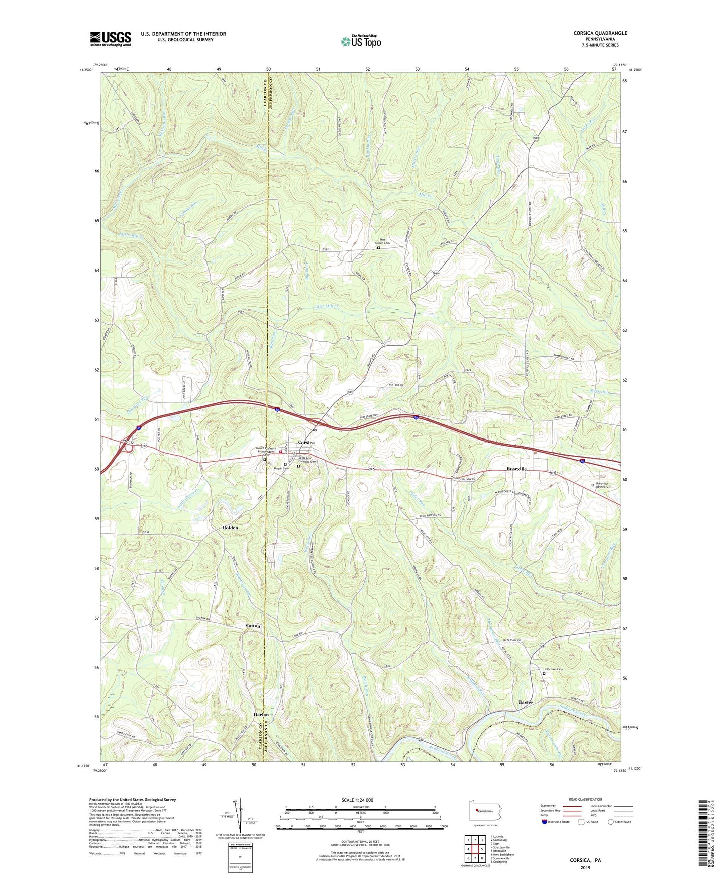
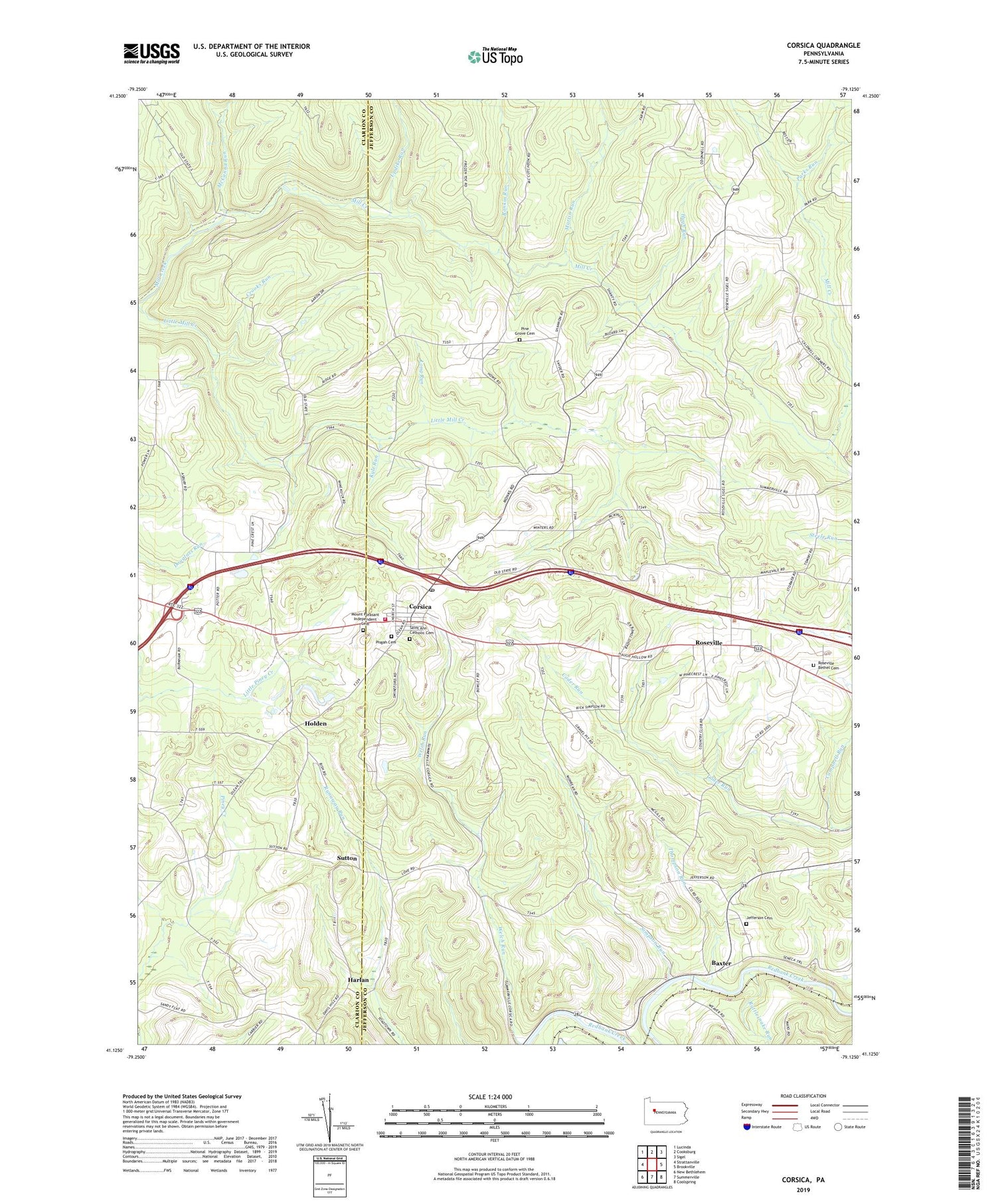
2019 topographic map quadrangle Corsica in the state of Pennsylvania. Scale: 1:24000. Based on the newly updated USGS 7.5' US Topo map series, this map is in the following counties: Jefferson, Clarion. The map contains contour data, water features, and other items you are used to seeing on USGS maps, but also has updated roads and other features. This is the next generation of topographic maps. Printed on high-quality waterproof paper with UV fade-resistant inks.
Quads adjacent to this one:
West: Strattanville
Northwest: Lucinda
North: Cooksburg
Northeast: Sigel
East: Brookville
Southeast: Coolspring
South: Summerville
Southwest: New Bethlehem
Contains the following named places: Baxter, Borough of Corsica, Bully Hill School, Caldwell School, Campbell Run, Corsica, Corsica Furnace, Corsica Post Office, Corsica Volunteer Fire Company Station 3, Crooks Run, Deltaven Station, Fox School, Furnace School, Harlan, Hazel Dell School, Heidrich Scales Station, Heidrich Station, Holden, Hugh Run, Jefferson Cemetery, Kyle Run, Long Run, Martin Run, McCanna Run, Mill Creek School, Mount Pleasant Independent Cemetery, Oaks School, Orr Hill School, Parks Run, Pendleton Run, Pine Grove Cemetery, Pine Grove School, Pinecrest Golf Course, Pisgah Cemetery, Pleasant Hill Chapel, Pucketty, Rankin Run, Rattlesnake Run, Roseville, Roseville Bethel Cemetery, Ross School, Saint Ann Catholic Cemetery, Shirley Field, Simpson Run, Spangler Run, Sutton, Sutton Station, Thompson Run, Township of Clover, Township of Union, Updike Run, WMKX-FM (Brookville), ZIP Code: 15829