MyTopo
Cresson Pennsylvania US Topo Map
Couldn't load pickup availability
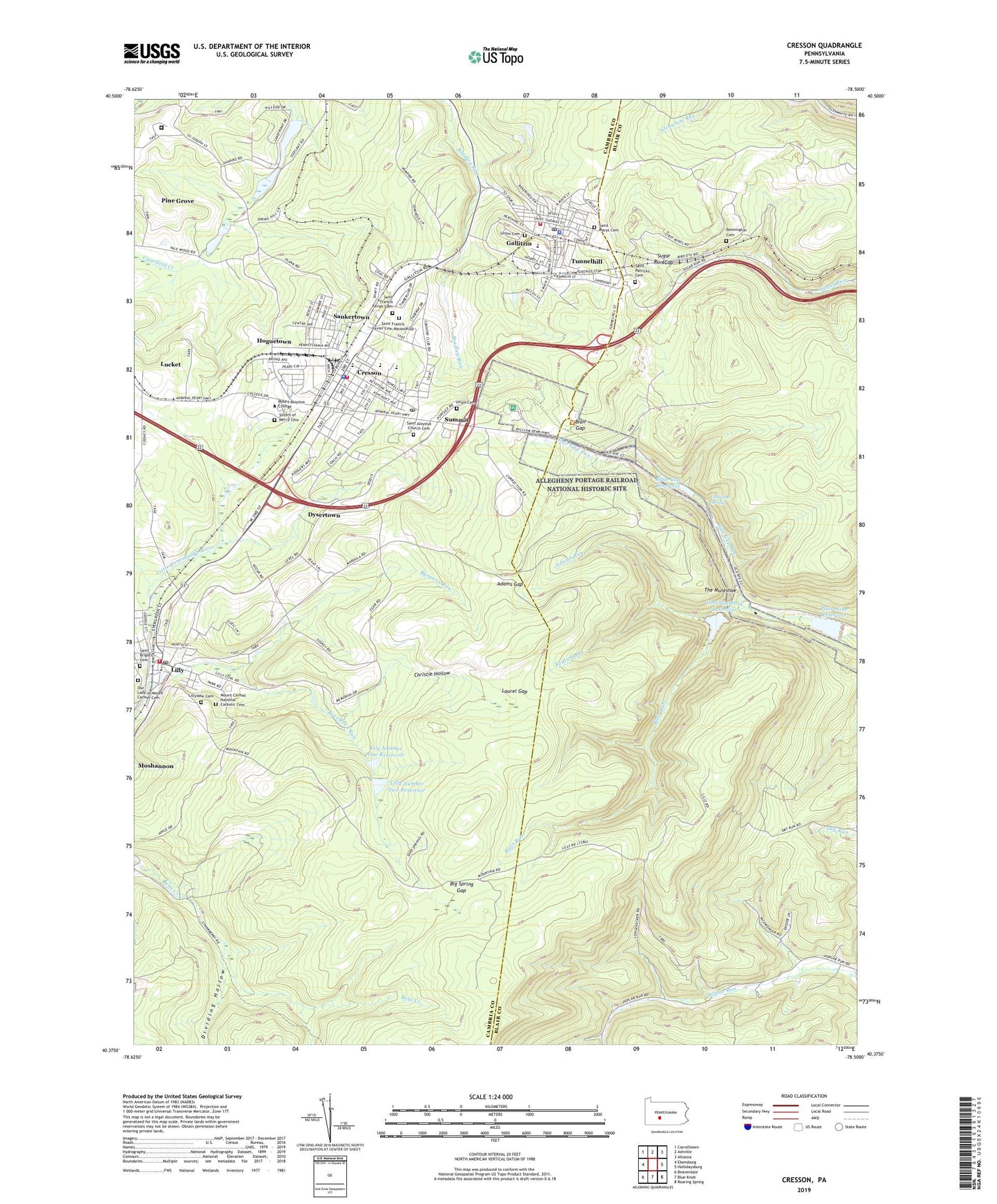
2023 topographic map quadrangle Cresson in the state of Pennsylvania. Scale: 1:24000. Based on the newly updated USGS 7.5' US Topo map series, this map is in the following counties: Cambria, Blair. The map contains contour data, water features, and other items you are used to seeing on USGS maps, but also has updated roads and other features. This is the next generation of topographic maps. Printed on high-quality waterproof paper with UV fade-resistant inks.
Quads adjacent to this one:
West: Ebensburg
Northwest: Carrolltown
North: Ashville
Northeast: Altoona
East: Hollidaysburg
Southeast: Roaring Spring
South: Blue Knob
Southwest: Beaverdale
This map covers the same area as the classic USGS quad with code o40078d5.
Contains the following named places: Adams Gap, Adams Run, Admiral Perry Park, Allegheny Portage Railroad National Historic Site, Allegrippus, Bear Rock Dam One, Bear Rock Dam Two, Bear Rock Run, Bennington, Bennington Cemetery, Big Spring Gap, Blair Gap, Blair Gap Dam, Blair Gap Reservoir, Blair Run, Borough of Cresson, Borough of Gallitzin, Borough of Lilly, Borough of Sankertown, Borough of Tunnelhill, Burgoon Run, Cambria Alliance Emergency Medical Service Station 75, Christie Hollow, Cresson, Cresson Borough Police Department, Cresson Dam, Cresson Lake, Cresson Post Office, Cresson Volunteer Fire Company Station 70, Dividing Hollow, Dysertown, Federal Correctional Institution Loretto, Gallitzin, Gallitzin Area Ambulance Service, Gallitzin Borough Police Department, Gallitzin Fire Company Station 71, Gallitzin Post Office, Gallitzin Spring, Hoguetown, Hollidaysburg Dam, Hollidaysburg Reservoir, Laurel Gap, Lawrence Flick State Hospital, Lilly, Lilly Area Ambulance Association Station 74, Lilly Community Volunteer Fire Company Station 72, Lilly Number Two Reservoir, Lilly Post Office, Lilly Reservoirs, Lilly Station, Lillydale Cemetery, Lily Number One Reservoir, Lucket, Mount Aloysius Junior College, Mount Carmel National Catholic Cemetery, Our Lady of Mount Carmel Cemetery, Pine Grove, Plain Nine Dam, Plain Nine Reservoir, Redlick Run, Saint Aloysius Church, Saint Aloysius Church Cemetery, Saint Brigid's Cemetery, Saint Francis Seminary, Saint Francis Xavier Cemetery, Saint Francis Xavier Cemetery Mausoleum, Saint Marys Cemetery, Saint Patricks Cemetery, Sankertown, Sisters of Mercy Cemetery, State Game Lands Number 198, State Game Lands Number 279, Sugar Run Gap, Summit, Summit Golf Course, The Muleshoe, Township of Cresson, Township of Juniata, Township of Washington, Tunnelhill, Union Cemetery, WBXQ-FM (Cresson), ZIP Codes: 15938, 16630, 16699