MyTopo
Curtisville Pennsylvania US Topo Map
Couldn't load pickup availability
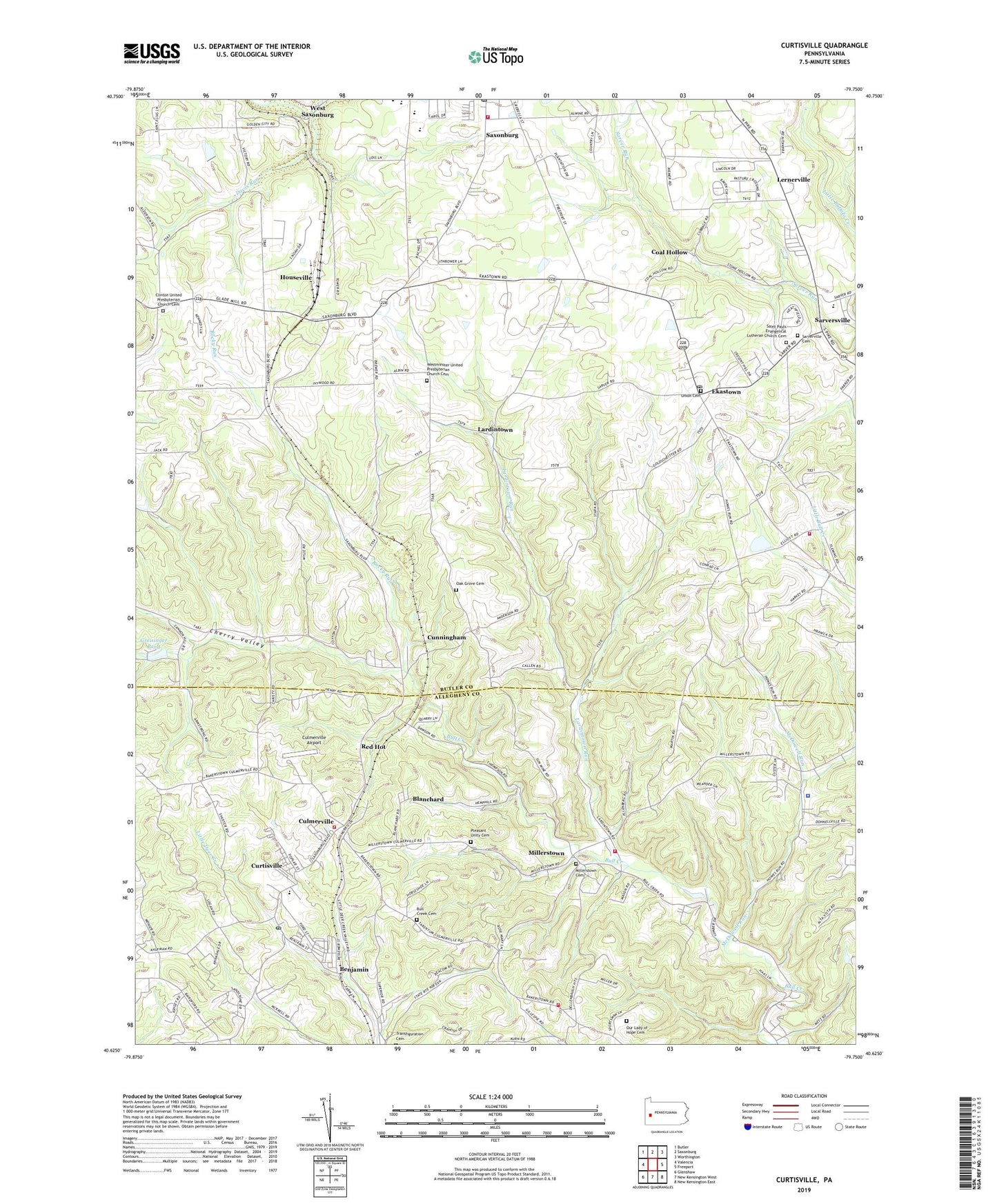
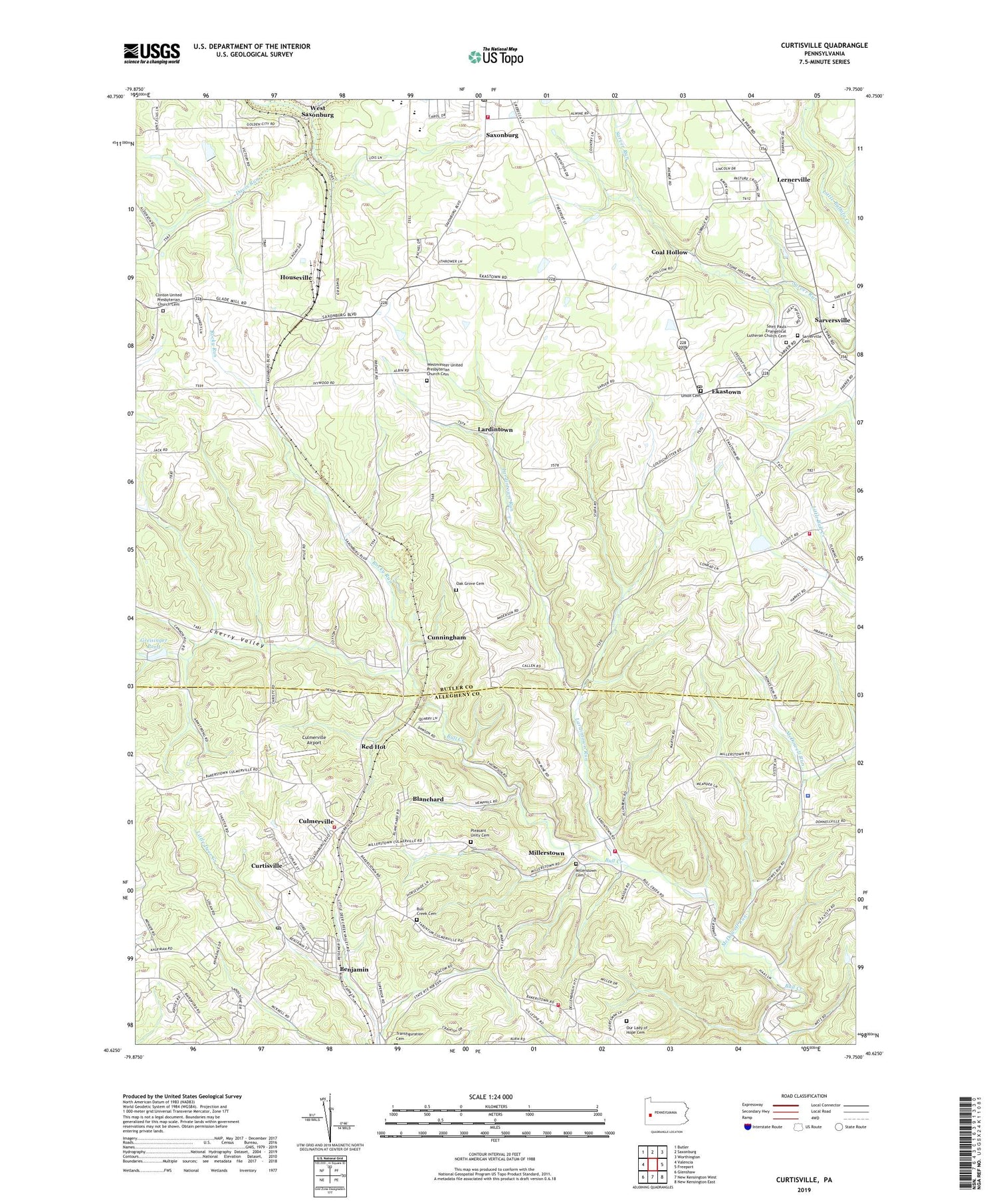
2019 topographic map quadrangle Curtisville in the state of Pennsylvania. Scale: 1:24000. Based on the newly updated USGS 7.5' US Topo map series, this map is in the following counties: Butler, Allegheny. The map contains contour data, water features, and other items you are used to seeing on USGS maps, but also has updated roads and other features. This is the next generation of topographic maps. Printed on high-quality waterproof paper with UV fade-resistant inks.
Quads adjacent to this one:
West: Valencia
Northwest: Butler
North: Saxonburg
Northeast: Worthington
East: Freeport
Southeast: New Kensington East
South: New Kensington West
Southwest: Glenshaw
Contains the following named places: Benjamin, Blanchard, Buffalo Township Elementary School, Buffalo Township Emergency Medical Ambulance Services, Bull Creek Cemetery, Bull Creek Church, Carnegie Institute of Technology, Cherry Valley, Clinton, Clinton Church, Clinton Elementary School, Clinton United Pentecostal Church, Clinton United Presbyterian Church Cemetery, Coal Hollow, Cooper Airport, Culmerville, Culmerville Airport, Cunningham, Curtisville, Curtisville Census Designated Place, Curtisville Post Office, Davis Run, Deer Creek United Presbyterian Church, East Union United Presbyterian Church, Ekastown, Fawn Township Police Department, Fawn Township Volunteer Fire Department 1 Station 150, Frazer Township Volunteer Fire Department 1 Station 159, Greisinger Dam, Greisinger Pond, Houseville, Ivywood, Knoch Junior Senior High School, Lardintown, Lardintown Run, Lernerville, McDowell Run, Millerstown, Millerstown Methodist Cemetery, Mineral Spring, Oak Grove Cemetery, Our Lady of Hope Cemetery, Pleasant Unity Cemetery, Pleasant Unity Church, Red Hot, Rocky Run, Saint Andrew the Apostle Byzantine Catholic Church, Saint Paul Church, Saint Pauls Evangelical Lutheran Church Cemetery, Saint Victors Church, Sarver Post Office, Sarver Volunteer Fire Company Station 36, Sarversville, Sarverville Cemetery, Saxon Airport, Saxon Golf Course, Saxonburg Post Office, Saxonburg Volunteer Fire Department Station 15, Township of Clinton, Township of Fawn, Township of West Deer, Transfiguration School, Union Cemetery, West Deer Township Volunteer Fire Department 1 Station 288, West Saxonburg, Westminster Church, Westminster United Presbyterian Church Cemetery, Woods, ZIP Codes: 15084, 16056