MyTopo
Worthington Pennsylvania US Topo Map
Couldn't load pickup availability
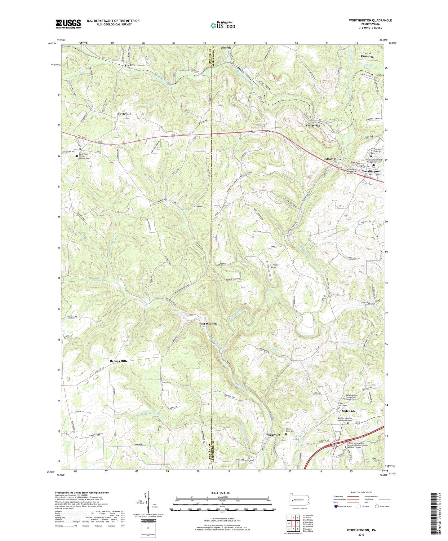
2023 topographic map quadrangle Worthington in the state of Pennsylvania. Scale: 1:24000. Based on the newly updated USGS 7.5' US Topo map series, this map is in the following counties: Armstrong, Butler. The map contains contour data, water features, and other items you are used to seeing on USGS maps, but also has updated roads and other features. This is the next generation of topographic maps. Printed on high-quality waterproof paper with UV fade-resistant inks.
Quads adjacent to this one:
West: Saxonburg
Northwest: East Butler
North: Chicora
Northeast: East Brady
East: Kittanning
Southeast: Leechburg
South: Freeport
Southwest: Curtisville
This map covers the same area as the classic USGS quad with code o40079g6.
Contains the following named places: Blue Slate Cemetery, Boggsville, Borough of Worthington, Buffalo Mills, Buffalo United Presbyterian Church Cemetery, Clearfield School, Cornplanter Run, Coyleville, Craigsville, Craigville Brach Junction Station, Dennys Mills, Fenelton, Fenelton Post Office, J T Willie Airport, Kittanning 6 Emergency Medical Services Station 130 - 2, Laird Crossing, Laird Station, Little Buffalo Run, Long Run, Marrowbone Run, McKee Chapel, Nichola, North Branch Rough Run, Patterson Creek, Reformed Presbyterian Church, Rough Run, Saint Johns Church, Saint Johns Roman Catholic Cemetery, Sarver Run, Shadyside Village, Sipes Run, Slate Lick, Slate Lick Cemetery, Slate Lick United Presbyterian Cemetery, Township of Clearfield, Township of West Franklin, Township of Winfield, West Winfield, Worthington, Worthington - West Franklin Volunteer Fire Department Station 250, Worthington Borough Police Department, Worthington Evangelical Lutheran Cemetery, Worthington Post Office, Worthington Presbyterian Cemetery, Worthington United Presbyterian Cemetery, ZIP Codes: 16034, 16262