MyTopo
Dickinson Pennsylvania US Topo Map
Couldn't load pickup availability
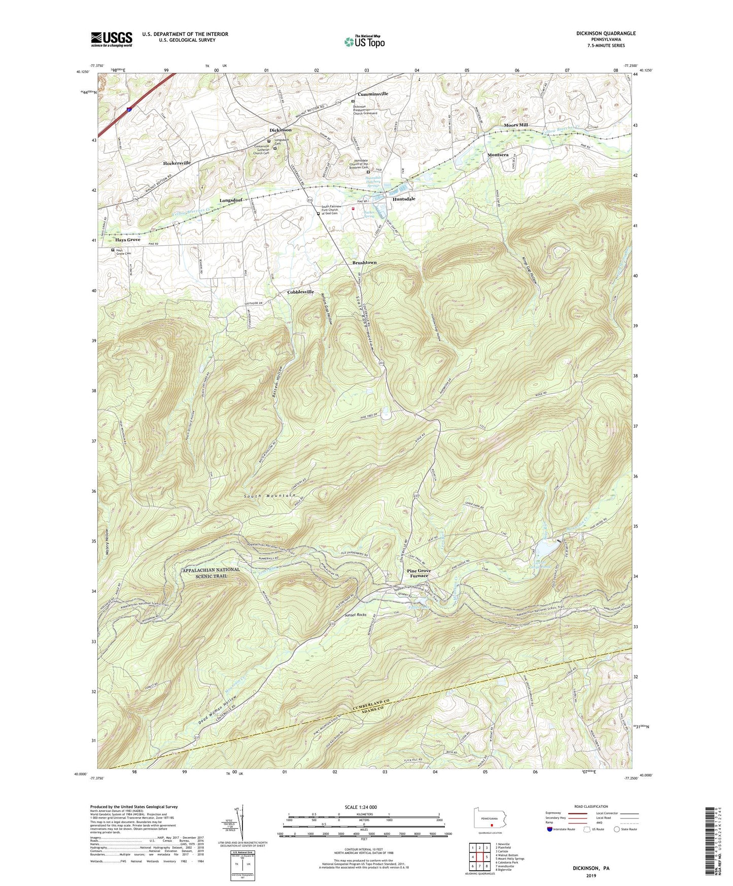
2019 topographic map quadrangle Dickinson in the state of Pennsylvania. Scale: 1:24000. Based on the newly updated USGS 7.5' US Topo map series, this map is in the following counties: Cumberland, Adams. The map contains contour data, water features, and other items you are used to seeing on USGS maps, but also has updated roads and other features. This is the next generation of topographic maps. Printed on high-quality waterproof paper with UV fade-resistant inks.
Quads adjacent to this one:
West: Walnut Bottom
Northwest: Newville
North: Plainfield
Northeast: Carlisle
East: Mount Holly Springs
Southeast: Biglerville
South: Arendtsville
Southwest: Caledonia Park
Contains the following named places: Ant Mount Trail, Appalachian Trail Museum, Bettem Hollow, Big Hill, Boundary Trail, Brushtown, Bucher Spring, Buck Ridge Tower, Camp Michaux, Centerville Lutheran Church Cemetery, Chimney Rocks, Church of Christ, Church of the Brethren, Cobblesville, Cumminsville, Cumminsville School, Dead Woman Hollow, Dickinson, Dickinson Church, Dickinson Presbyterian Church Graveyard, Doners Station, Forest School, Fuller Lake, Hammonds Rocks Trail, Hays Grove, Hays Grove Cemetery, Hockersville, Huntsdale, Huntsdale Church of the Brethren Cemetery, Huntsdale Hatchery Springs, Huntsdale State Fish Hatchery, Irishtown Gap Hollow, Iron Run, Kellars Gap Hollow, Kings Gap Hollow, Kings Gap Hollow Trail, Kings Gap State Park, Laurel Dam, Laurel Forge Pond, Lewis Rocks, Little Rocky Ridge, Longsdorf, Longsdorfs Cemetery, Maple Hollow Trail, Montsera, Moors Mill, Peach Orchard Hollow, Penn Township Consolidated School, Penn Township Volunteer Fire Department Station 50, Pentecostal Church, Pine Grove Chapel, Pine Grove Furnace, Pine Grove Furnace Stack, Pine Grove Furnace State Park, Pine Plantation Trail, Pinnacle Mountain, Pole Steeple, Ridge Trail, Rock Skree Trail, Sage Run, Saint Eleanor Regina, Scenic Vista Trail, South Fairview Church, South Fairview First Church of God Cemetery, State Road Hollow, Sunset Rocks, Toms Run, Tomstown Dolomite Quarry, Township of Cooke, Township of Penn, Tumbling Run Game Preserve, Watershed Trail